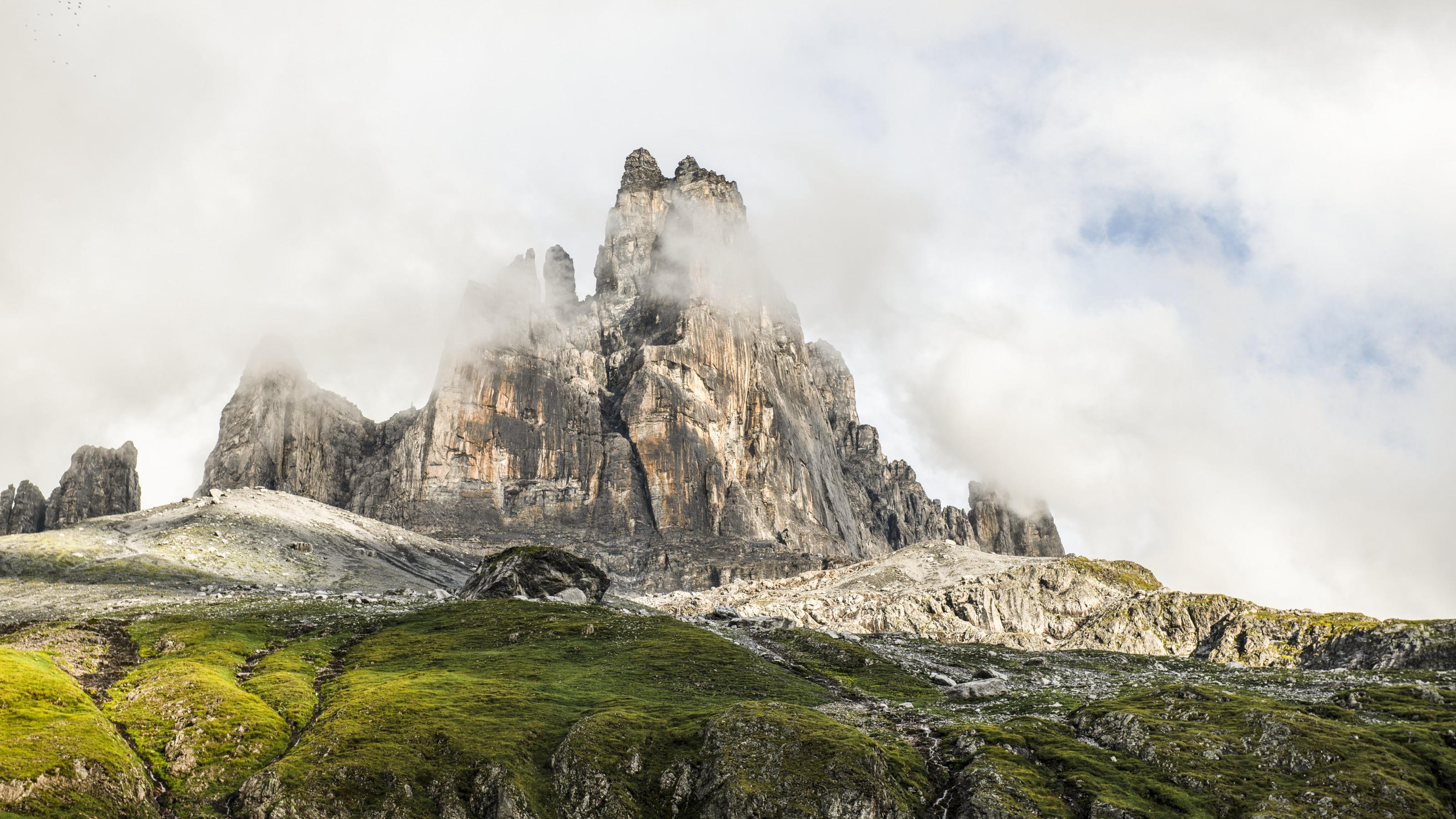
When the work is done, it’s time for fun: After a steep section, the trail leads over a scenic ridge to the historic Surenenpass. The rock bastions on Brunnistock and the valley basin are imposing. A varied valley trail leads to the monastery town of Engelberg.

..Engelberg&freizeit=1&noweather=1&width=400&height=200&x_axis_display=distance&polyline=enfi%40cywJ%7B%5B%3FxCzNIkRdEpG%40gQmHtKMcQuKtGOoQ%7EErJFiQlLbILeRlL%60IN%7DPnJrMHeR%7EJrIHwPdFtL%40aRtHfLUyPtK%7EHu%40wQzNbGuAkQnHhNeBqQxBlNaBkQjArOcCqQbFtNqDmQO%60J%7BBcQpFrK%7BDuQ%60HbFyDiQ%7EBrHsDoQnIpBmDaRdGjIqDgQxDlDoDcQdHpGcBoQ%7COyD%7BAsQaGmDsAqQpMaA_ByQhOyAaA_QrN%7E%40mAmQvNDmAmQxOqAyBqQ%60O%7BCgAuQjNqGgCoQxMxGwAmQfPnCe%40gQbPtCVsQrPwAk%40mQpPnAc%40sQxMjA%7BAiQhNpEiBoQ%7EMzGv%40mQzI%7EJ%40mQrKnGqBoQlK%3FkDqQ%7EGfHwCmQvD%7CFoAqQnBzLpBqQpJfK%60CoQdKvKzBgQhNnHfByQjOfBhBgQxPhA%7C%40sQzPf%40jBiQnQUrAwQtOpD%7E%40gQfN%60IxAoQzE%60Jh%40sQ%7EB%7EOv%40mQrGhM%5CoQjHjNd%40qQpLjJx%40iQ%7EJ%60JhAoQlApL%7CBkQfA%60PfCsQ%7ECvOjAoQpHdNr%40sQxEnOj%40iQfKjLToQvIzL%7E%40mQpMhHxA%7BQ%60O%7EFPaQzM%7CHtAsQhJhKv%40sQ%7CNhG%5CiQfPmADuQxOs%40b%40cQfOj%40x%40oQfOyD%5CuQjMcJAcRfKeKz%40wPdLqK%7C%40%7DQtNoI%5C_RvMeHPmP%7CG%7BNToQxK_LPmQjNmI%40yQpOeDHcQbOkIDeR%7CJmLLeQhL%7DKFqQpDqON_QdK%7DIPaRrPsE%40eRdNqFBkPvQe%40EuRdPsDMgQbLDb%40mPxP%7D%40RqQfI%60JDgQ)