DE
FR
IT
EN
Directory
Weather
Map / Route
Timetable
Leisure
TV guide
Cinema
Web search
Apps
More
Personal Data »
Login:
Register
Password forgotten
or
Log in with local.ch
Log in with Apple
Log in with Facebook
Log in with Google
Log in with LinkedIn
Please note that our new
privacy statement
as well as the revised
terms and conditions of use
apply.
Leisure
Biking in Aargau – Solothurn region
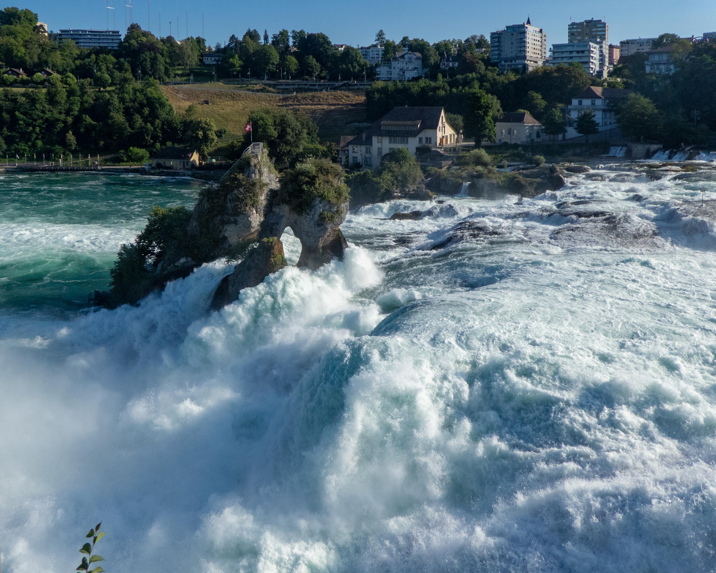
Rhine Route
National route No. 2, Schaffhausen–Bad Zurzach
Description
National route
No. 2 (Schaffhausen–Bad Zurzach)
Length
53 km
Ascent • Descent
↑ 480 m • ↓ 540 m
Lowest point • Highest point
335 m • 454 m
Fitness level
medium
The Upper Rhine has carved its bed between the Black Forest and the Jura mountains. The river is broad and sluggish at times, narrow and temperamental at others. Attractive floodplains and historic river towns add cultural enjoyment to this day.
Comments on this information?
We welcome your feedback!
Presented by
Route
Height profile
Weather:
More...
Comments about this activity or place?
Incorrect information
Missing information
Another topic
Thank you for your feedback!
Close