search.ch

ViaSuworow

Regional route No. 55, Airolo–Gotthardpass
  • Image 1

Description

Regional route
No. 55 (Airolo–Gotthardpass)
Length
7 km
Ascent • Descent
↑ 950 m • ↓ 20 m
Lowest point • Highest point
1142 m • 2093 m
Hiking time
3 h
Grade
medium (mountain hiking trail)
Fitness level
difficult
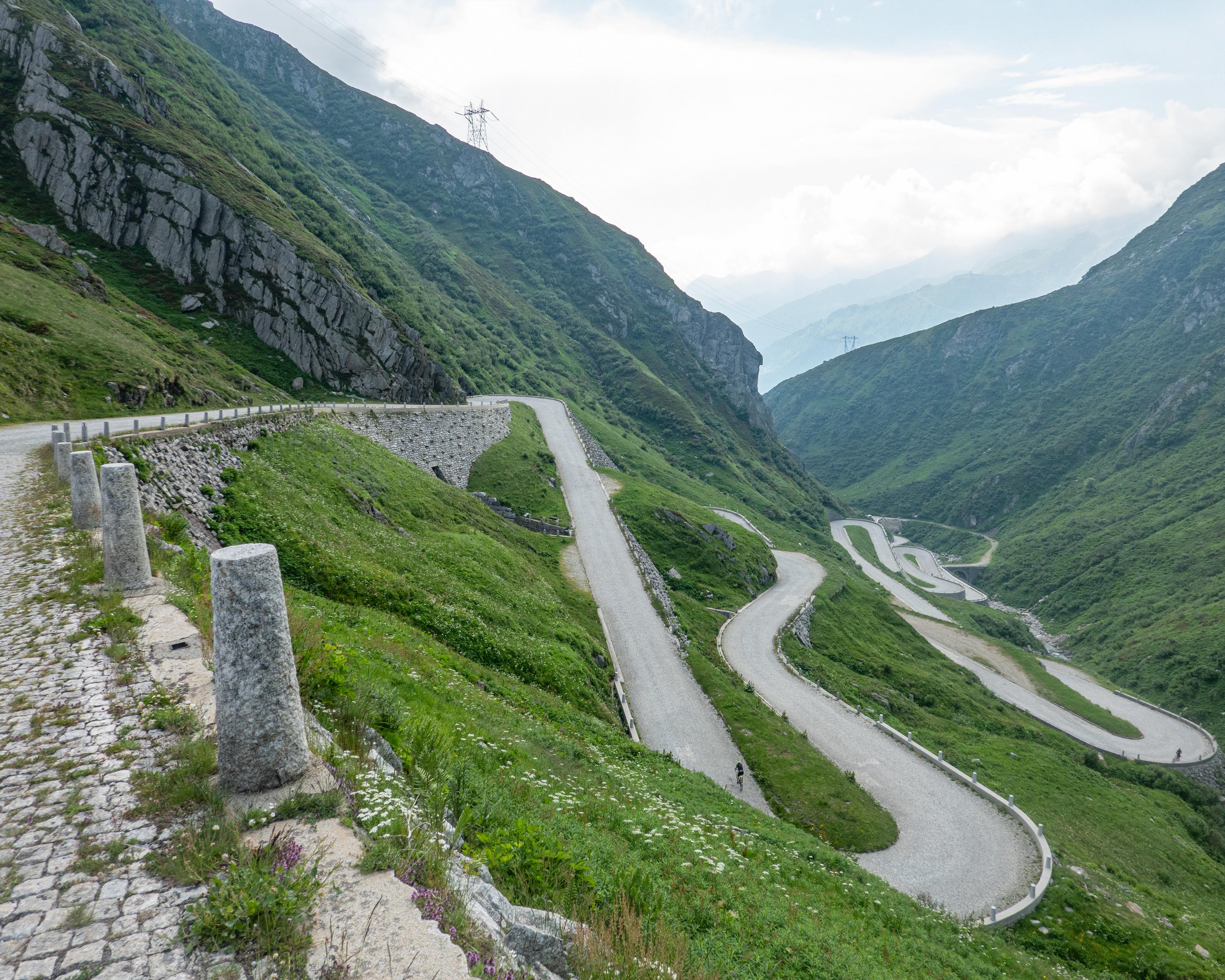
After a steep climb through the Tremola, views open up to the Totenkapelle (Chapel of the Dead) and the Susten on the Gotthardpass. The pass head is «conquered» via the old trading route, just as Suvorov and his troops did after the French retreated.

Height profile

Weather:

Comments about this activity or place?

Thank you for your feedback!