search.ch

Via Albula/Bernina

Regional route No. 33, St. Moritz–Ospizio Bernina
  • Image 1

Description

Regional route
No. 33 (St. Moritz–Ospizio Bernina)
Length
24 km
Ascent • Descent
↑ 840 m • ↓ 360 m
Lowest point • Highest point
1732 m • 2266 m
Hiking time
6 h 30 min
Grade
medium (mountain hiking trail)
Fitness level
difficult
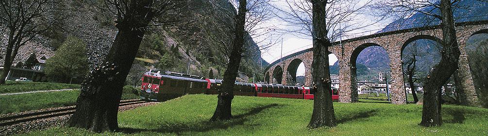
A gentle, steady climb through moor landscapes and Alpine pastures to the Bernina pass. The protected Staz forest, the Pontresina mountain resort, the Morteratsch glacier world and the highest peaks in the Graubünden region make this an unforgettable tour.

Height profile

Weather:

Comments about this activity or place?

Thank you for your feedback!