search.ch

Trans-Altarezia Bike

Regional route No. 32, Scuol–Sta. Maria
  • Image 1

Description

Regional route
No. 32 (Scuol–Sta. Maria)
Length
48 km
Ascent • Descent
↑ 1700 m • ↓ 1600 m
Lowest point • Highest point
942 m • 2310 m
Grade
difficult
Fitness level
difficult
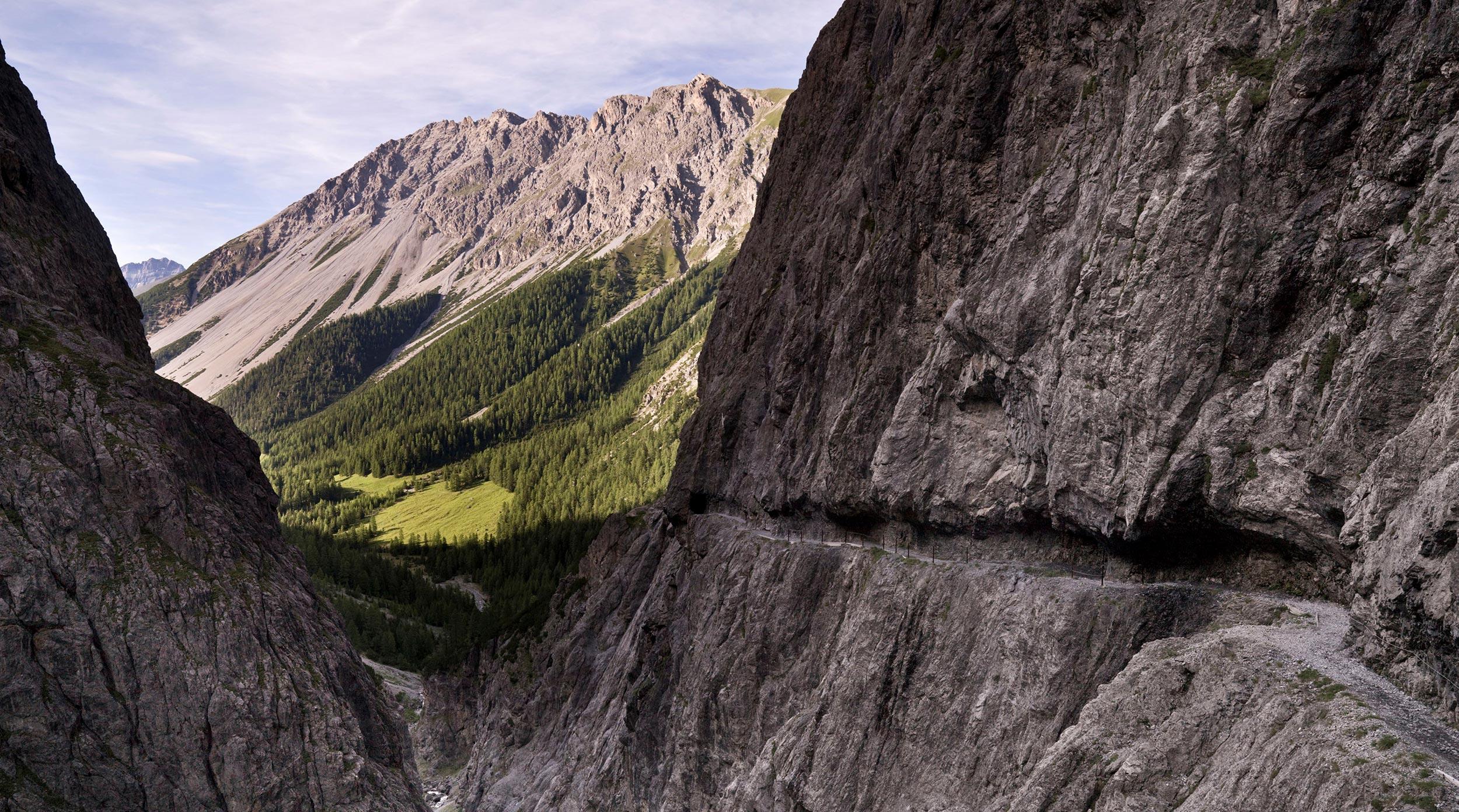
From Sur En, the route leads through a gorge full of variety. The highlight of the route is the spectacular Val d’Uina cliff trail, notorious among bikers. Over the Sesvenna Pass on Italian soil you reach Schlinigertal and finally enter the Val Müstair with its stage stop, Sta. Maria.

Height profile

Weather:

Comments about this activity or place?

Thank you for your feedback!