DE
FR
IT
EN
Directory
Weather
Map / Route
Timetable
Leisure
TV guide
Cinema
Web search
Apps
More
Personal Data »
Login:
Register
Password forgotten
or
Log in with local.ch
Log in with Apple
Log in with Facebook
Log in with Google
Log in with LinkedIn
Please note that our new
privacy statement
as well as the revised
terms and conditions of use
apply.
Leisure
Hike in Thurgau
Stählibuckweg
Local route No. 908, Amlikon–Frauenfeld
Description
Local route
No. 908 (Amlikon–Frauenfeld)
Length
17 km
Ascent • Descent
↑ 420 m • ↓ 440 m
Lowest point • Highest point
399 m • 657 m
Hiking time
4 h 20 min
Grade
easy (hiking trail)
Fitness level
medium
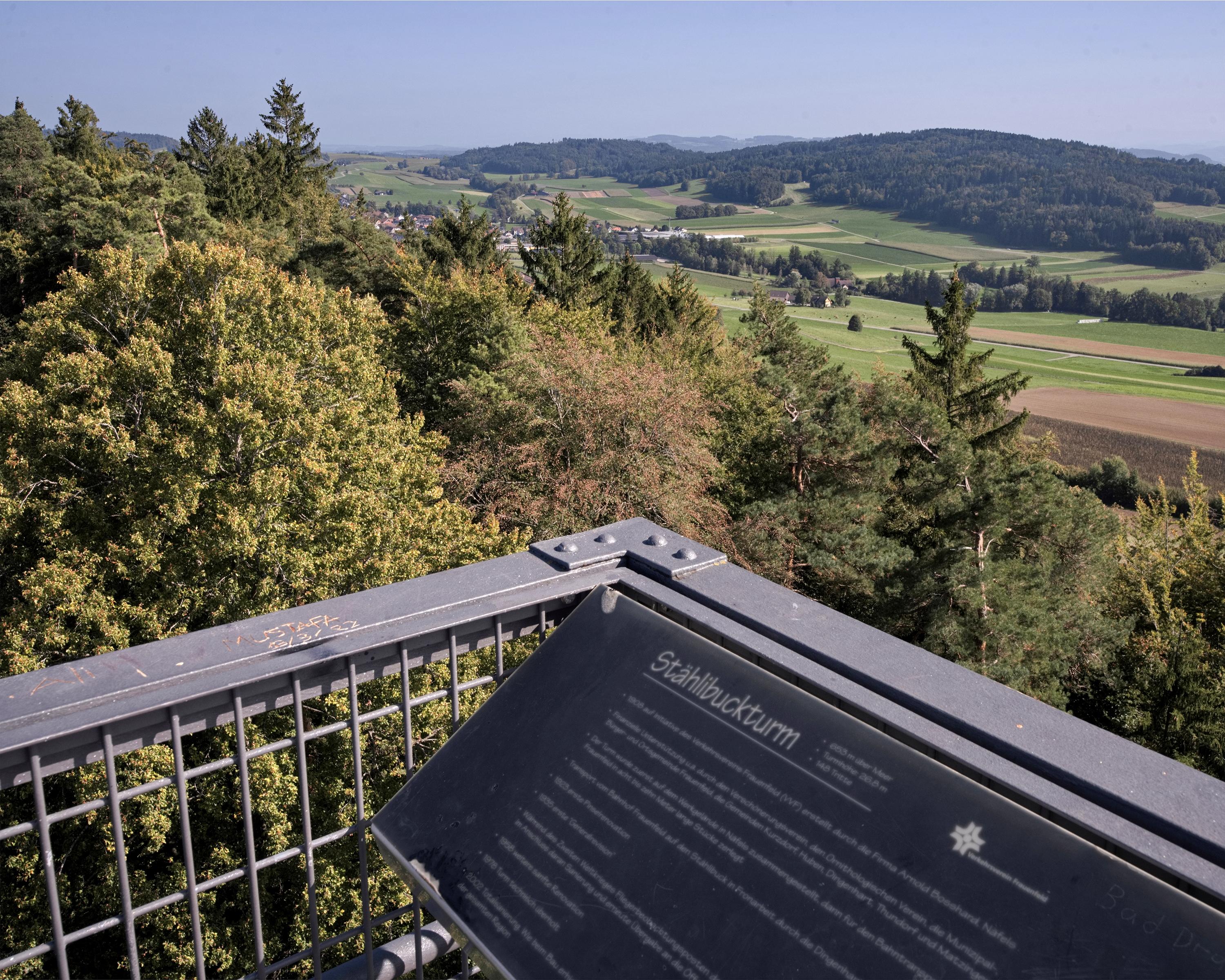
The hike from Amlikon to Frauenfeld leads between Thur and Lauche over the Wellenberg. Passing interesting buildings, the trail arrives at the well-known Stälibuck view tower by Frauenfeld, which provides a splendid panoramic view on clear days.
Booking Information
E-mail:
info@thurgau-bodensee.ch
Comments on this information?
We welcome your feedback!
Presented by
Route
Height profile
Weather:
More...
Thurgau Tourismus
Friedrichshafnerstrasse 55a, 8590 Romanshorn
Thurgau Tourismus
Friedrichshafnerstrasse 55a, 8590 Romanshorn
071 531 01 31
Comments about this activity or place?
Incorrect information
Missing information
Another topic
Thank you for your feedback!
Close