DE
FR
IT
EN
Directory
Weather
Map / Route
Timetable
Leisure
TV guide
Cinema
Snow
Web search
Apps
More
Personal Data »
Login:
Register
Password forgotten
or
Log in with local.ch
Log in with Apple
Log in with Facebook
Log in with Google
Log in with LinkedIn
Please note that our new
privacy statement
as well as the revised
terms and conditions of use
apply.
Leisure
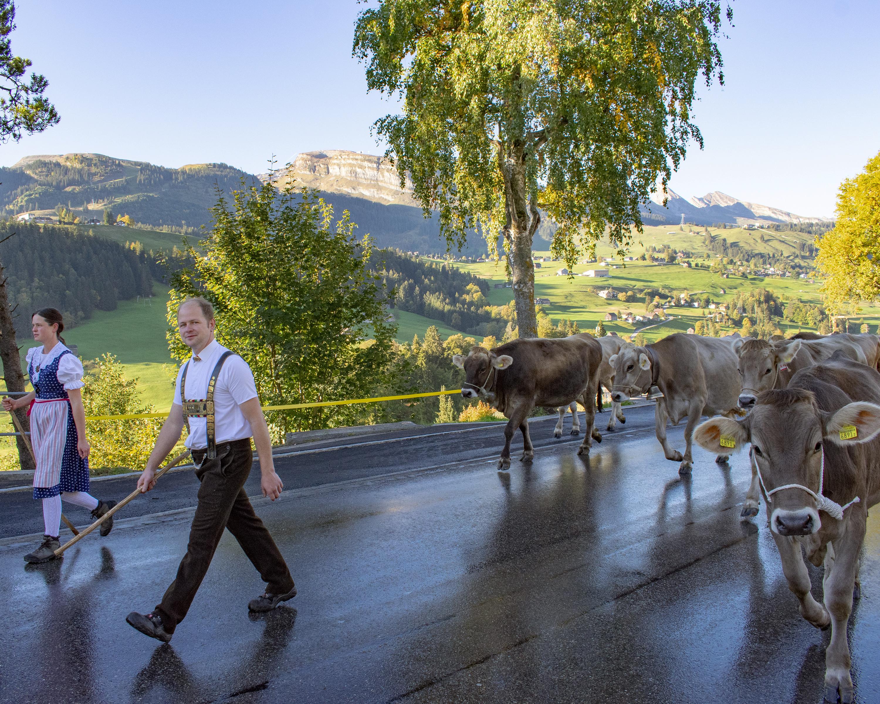
Biking in Zurich Region
Thur-Route
Regional route No. 95, Andelfingen (Ellikon a.R.) – Buchs SG
Description
Regional route
No. 95 (Andelfingen (Ellikon a.R.) – Buchs SG)
Length
145 km
Ascent • Descent
↑ 1650 m • ↓ 1550 m
Lowest point • Highest point
351 m • 1050 m
Fitness level
medium
Regional route No. 95: Thur-Route
Stages
0. Ellikon am Rhein – Bischofszell
0. Bischofszell – Nesslau
0. Nesslau – Buchs
The multi-faceted Thur is your constant route companion, leading from where it flows into the Rhine, over the dams in Thurgau, through rugged Toggenburg woodland and up to its headwater near the Alpstein massif.
Comments on this information?
We welcome your feedback!
Presented by
Route
Height profile
Weather:
More...
Comments about this activity or place?
Incorrect information
Missing information
Another topic
Thank you for your feedback!
Close

..Buchs+SG&freizeit=1&noweather=1&width=400&height=200&x_axis_display=distance&polyline=qm%7Dh%40%7DrtOeU%3FanAxd%40SszAapAbRYe%7BAweAgJNuyAsoA%7CWLozAgoAaQiA%7ByAgeAnFOozA%7DpAu%40j%40s%7DAmkAhNZixA_%7E%40bOA_yAukAuQ%40m%7DAulAtf%40AuwAopAnd%40Cm%7BAkpAjWCy%7BAutAf%40CgwAcqAlOEi%7EAs%7E%40%7Ca%40CqwAccAz%5Ec%40uyAo%60AlLCe%7BA%7B_%40fZAwyAqcAkg%40J%7ByAapAq%5EEezA%7DnAsW%5DozAelAw%5E%5CizAak%40wy%40BmzAmfANEm_BmrApLG%7DuAquAlJIkyAqsA%7C%5EEszAmuAdQGgzAubAxz%40Ik%7DAicAjd%40OawAqnATAyzAk%7B%40ja%40%40%7D%7CAspApEE%7DwA_pAb%60%40Gc%7CAweAvt%40GsxAkt%40%60gAIezAsqAjGGgzAcTht%40_%40%7BzA_f%40pmAMuyAen%40xhALozAirAhVEezAQ%7CSaA%7DzAdu%40pdAAizAjfA%7Cd%40z%40kzAplAtk%40KgcBl%7E%40bv%40G%7DrAfmApKEoxAfiAn%5CIm%7DAtuAeLEmwAheAg_%40SczAd%7D%40%7E%60%40AszAp%7C%40zf%40w%40syAjLfe%40gA%7BzAfTjmAEwzAek%40%7CgAm%40izA%7CHfoAu%40%7DyAvJbc%40h%40gzAoEluA%60%40gzA%7DZ%7ClAW%7D%7BAvLvhAFayAgCjnA%5B_zAzd%40fy%40JqzAm%5BdcABezAqPthAw%40gzAbF%60kAVyzA%7EMx%7D%40PyyA%7BUfdAG_%7BAqg%40zeAIk%7BAkEfq%40QeyA%7Bj%40fqAQe_Bk%7D%40hx%40HwuAs_Ark%40YuyAe%7D%40%60Z%7DAw%7BAyk%40%7Er%40kBayAycAkCh%40czAio%40%60p%40kAqzAwaAdo%40Jy%60Bwp%40v%7B%40C%7DsAkcAzm%40%7BBqzAwa%40fmAs%40czAyi%40%60lACczA_aA%7Ek%40aAyzAaoAz%40AizAgmA%7Dj%40MgzAeqAiYOq%7BA_vAyEy%40wxAojAmZeDuzAawAS_%40i%7BAusAfDb%40ayAgxApDdEkzAogAb%60%40IuzAyhA%60YfCkzA%7De%40v%7D%40hCozAcQ%7Dq%40hE_zAkf%40fAzEizAye%40bVlDmzA%7Dq%40de%40l%40u%7BAo%7E%40%7E%60%40PcyAmv%40za%40E%7ByA)