DE
FR
IT
EN
Directory
Weather
Map / Route
Timetable
Leisure
TV guide
Cinema
Web search
Apps
More
Personal Data »
Login:
Register
Password forgotten
or
Log in with local.ch
Log in with Apple
Log in with Facebook
Log in with Google
Log in with LinkedIn
Please note that our new
privacy statement
as well as the revised
terms and conditions of use
apply.
Leisure
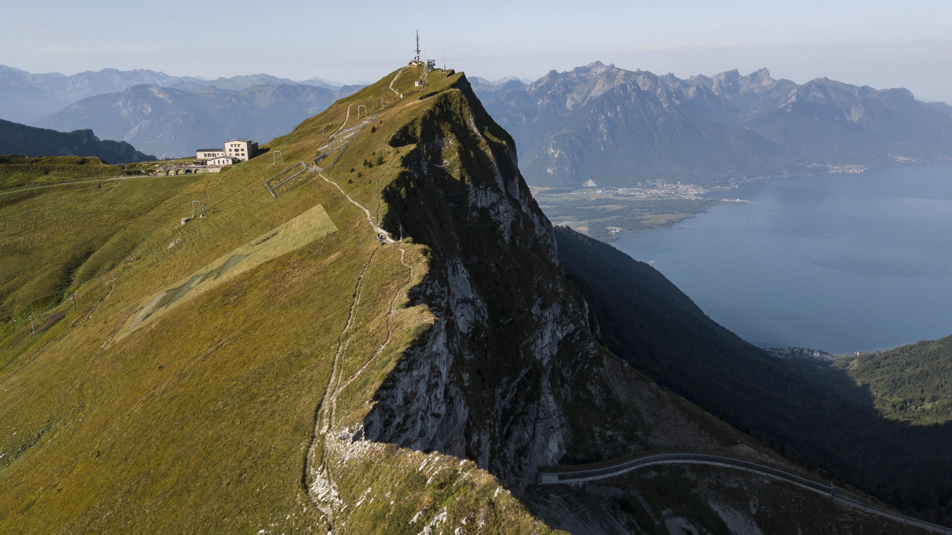
Hike in Caux
Via Alpina
National route No. 1, Rochers de Naye–Montreux
Description
National route
No. 1 (Rochers de Naye–Montreux)
Length
13 km
Ascent • Descent
↑ 90 m • ↓ 1650 m
Lowest point • Highest point
375 m • 1951 m
Hiking time
3 h 50 min
Grade
medium (mountain hiking trail)
Fitness level
difficult
From Rochers de Naye with its marmots, rock-restaurant and panorama of hundreds of crags and summits, the route leads along a steep ridge and sandstone cliff trail, later down over Mediterranean hills to Montreux.
Comments on this information?
We welcome your feedback!
Presented by
Route
Height profile
Weather:
More...
Comments about this activity or place?
Incorrect information
Missing information
Another topic
Thank you for your feedback!
Close