search.ch

Valais Alpine Bike

Regional route No. 41, Leukerbad–Unterbäch
  • Image 1

Description

Regional route
No. 41 (Leukerbad–Unterbäch)
Length
33 km
Ascent • Descent
↑ 580 m • ↓ 2200 m
Lowest point • Highest point
626 m • 2312 m
Grade
medium
Fitness level
easy
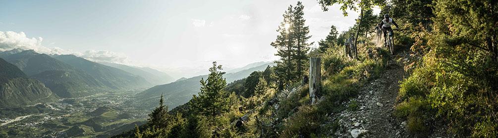
This stage features a flowing single trail high above Leukerbad. The high-altitude route with spectacular views over the Rhone Valley and the Valais's 4,000-metre peaks explores idyllic Alpine scenery, mountain villages and cultural landscapes. The rocky descent from Erschmatt down to Gampel offers plenty of fun.

Height profile

Weather:

Comments about this activity or place?

Thank you for your feedback!