DE
FR
IT
EN
Directory
Weather
Map / Route
Timetable
Leisure
TV guide
Cinema
Web search
Apps
More
Personal Data »
Login:
Register
Password forgotten
or
Log in with local.ch
Log in with Apple
Log in with Facebook
Log in with Google
Log in with LinkedIn
Please note that our new
privacy statement
as well as the revised
terms and conditions of use
apply.
Leisure
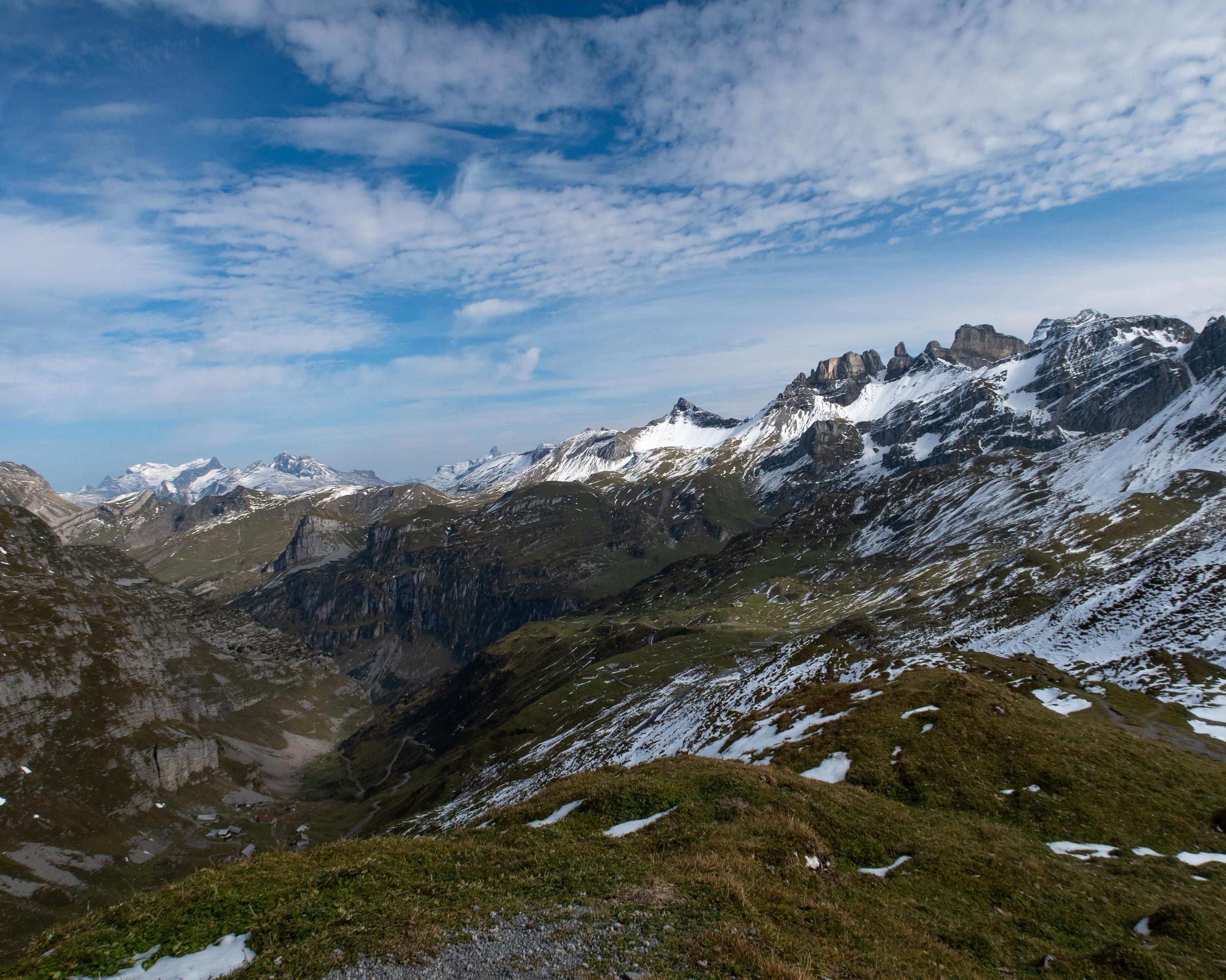
Hike in Lucerne – Lake Lucerne Region
ViaSuworow
Regional route No. 55, Biel-Chinzig–Muotathal
Description
Regional route
No. 55 (Biel-Chinzig–Muotathal)
Length
15 km
Ascent • Descent
↑ 500 m • ↓ 1500 m
Lowest point • Highest point
626 m • 2073 m
Hiking time
4 h 50 min
Grade
medium (mountain hiking trail)
Fitness level
difficult
The Chinzigpass awaits with bizarre rock formations and views of the Alps in the Chinzer and Hürital valleys. Unfortunately, Suvorov's troops saw little of these as they had to scale the pass with their heavy field guns on a dull, rainy day.
Comments on this information?
We welcome your feedback!
Presented by
Route
Height profile
Weather:
More...
Comments about this activity or place?
Incorrect information
Missing information
Another topic
Thank you for your feedback!
Close