DE
FR
IT
EN
Directory
Weather
Map / Route
Timetable
Leisure
TV guide
Cinema
Web search
Apps
More
Personal Data »
Login:
Register
Password forgotten
or
Log in with local.ch
Log in with Apple
Log in with Facebook
Log in with Google
Log in with LinkedIn
Please note that our new
privacy statement
as well as the revised
terms and conditions of use
apply.
Leisure
Hike in Lake Neuchâtel
Jura Crest Trail
National route No. 5, Vue des Alpes–Noiraigue
Description
National route
No. 5 (Vue des Alpes–Noiraigue)
Length
22 km
Ascent • Descent
↑ 860 m • ↓ 1400 m
Lowest point • Highest point
729 m • 1438 m
Hiking time
6 h 45 min
Grade
easy (hiking trail)
Fitness level
difficult
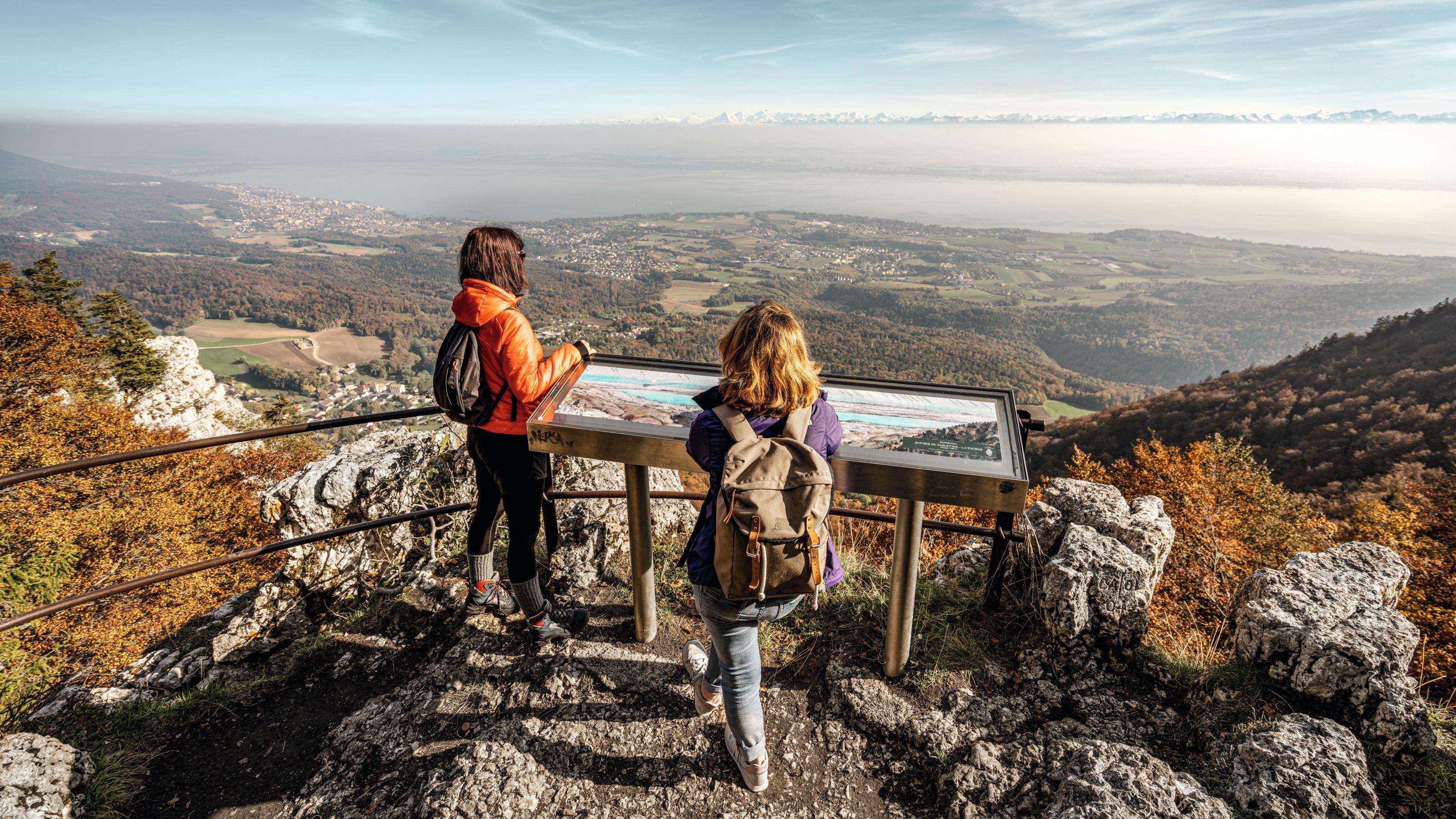
Enjoy the fantastic panoramic view from the high mountain chain with the Tête de Ran and Mont Racine peaks. The slabs of the rocky spur provide a breathtaking view down to Lac de Neuchâtel, before making the steep descent to Noiraigue.
Comments on this information?
We welcome your feedback!
Presented by
Route
Height profile
Weather:
More...
Comments about this activity or place?
Incorrect information
Missing information
Another topic
Thank you for your feedback!
Close