DE
FR
IT
EN
Directory
Weather
Map / Route
Timetable
Leisure
TV guide
Cinema
Snow
Web search
Apps
More
Personal Data »
Login:
Register
Password forgotten
or
Log in with local.ch
Log in with Apple
Log in with Facebook
Log in with Google
Log in with LinkedIn
Please note that our new
privacy statement
as well as the revised
terms and conditions of use
apply.
Leisure
Activités in Lac des Quatre-Cantons
Obwaldner Höhenweg
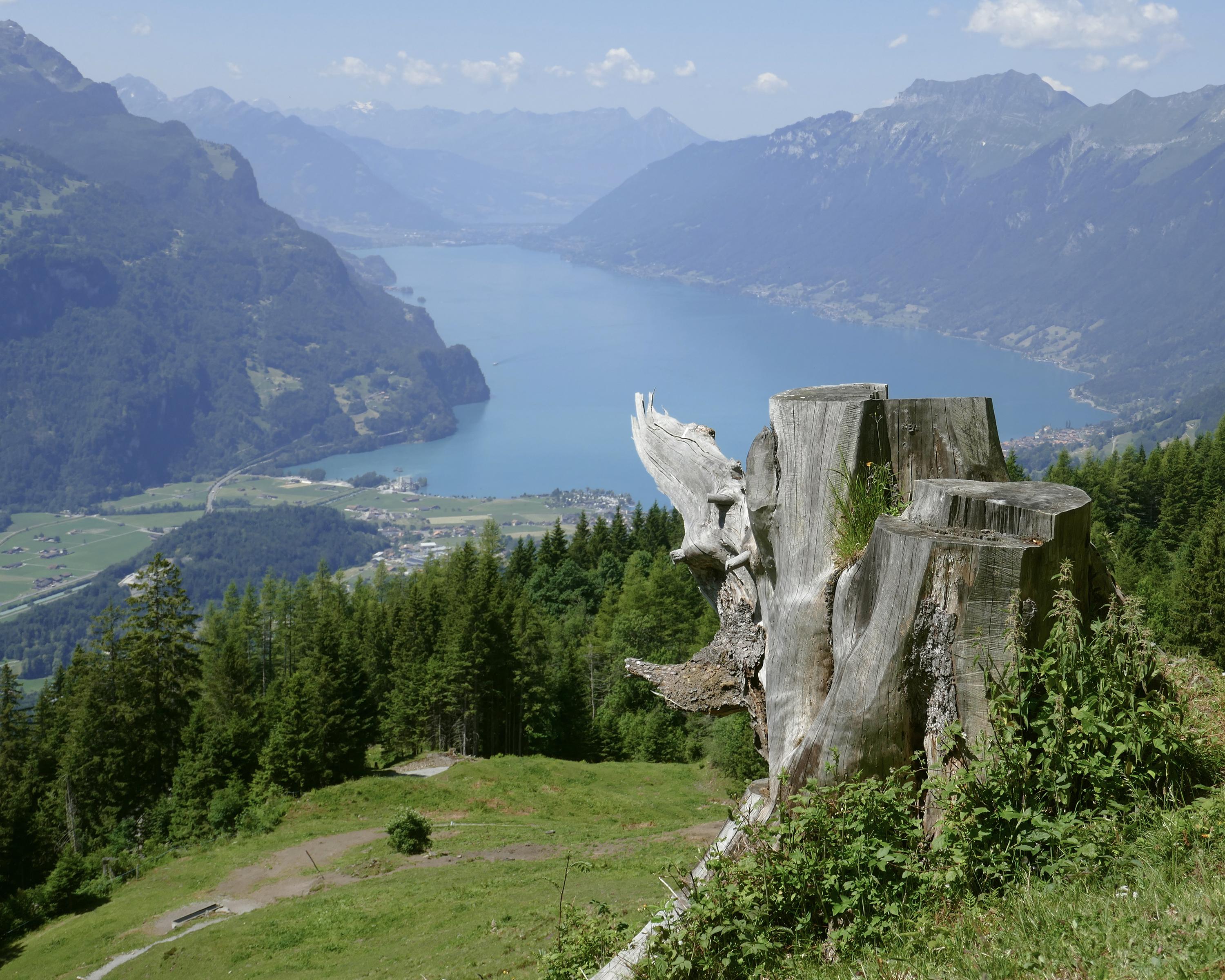
Regional route No. 57, Alpnachstad (Pilatus) – Stanserhorn
Description
Regional route
No. 57 (Alpnachstad (Pilatus) – Stanserhorn)
Length
99 km
Ascent • Descent
↑ 6300 m • ↓ 6500 m
Lowest point • Highest point
967 m • 2230 m
Grade
medium
Fitness level
difficult
Regional route No. 57: Obwaldner Höhenweg
Stages
0. Brünigpass – Melchsee-Frutt
0. Alpnachstad (Pilatus) – Langis
0. Schönbüel (OW) – Brünigpass
0. Melchsee-Frutt – Storeggpass
0. Langis – Schönbüel (OW)
0. Storeggpass – Stanserhorn
This six-day tour leads from Mount Pilatus via the geographic centre of Switzerland to Melchsee-Frutt and the Stanserhorn, always at lofty heights with fantastic views of countless Alpine peaks and dozens of mountain lakes.
Comments on this information?
We welcome your feedback!
Presented by
Route
Height profile
Weather:
More...
Comments about this activity or place?
Incorrect information
Missing information
Another topic
Thank you for your feedback!
Close

..Stanserhorn&freizeit=1&noweather=1&width=400&height=200&x_axis_display=distance&polyline=%7B%60lg%40%7BllK_%60C%3FjEfc%40nKi%7D%40rf%40lc%40vI%7D%7D%40%7Cj%40%60%5CbIu%7C%40%7BKvm%40zE%7D%7D%40f%5EbZ%60Gs%7C%40pv%40%5BnEi%7D%40zt%40cZgBs%7D%40vu%40uPoFa%7D%40hr%40%7DKwEi%7D%40ht%40uAmFk%7D%40pXdTaBk%7D%40eIrg%40%60%40e%7D%40aEz%5DfBa%7D%40be%40zd%40d%40q%7D%40tBtr%40iF_%7D%40lj%40%60_%40%7B%40g%7D%40%60l%40be%40%3Fk%7D%40%7Ej%40t%60%40gBe%7D%40b_%40lq%40pB%7D%7D%40f%5Ebo%40n%40s%7C%40oFhn%40dGk%7D%40eZdf%40%7CCw%7E%40bg%40jf%40Jk%7C%40zv%40n%40aC_%7D%40hc%40%7Ea%40gDa%7D%40l_%40%7CHuEg%7D%40nMxe%40gEs%7D%40p%5Edi%40%60D%7D%7C%40%60j%40%60_%40pEm%7D%40%7BHvi%40%40m%7D%40gClt%40B_%7D%40pEvn%40Xk%7D%40oOlo%40pBi%7D%40n%5Bvk%40%7C%40m%7D%40uNz%60%40G_%7D%40%7DVhp%40eB_%7E%40og%40da%40yB%7B%7C%40ef%40l%5E%5B_%7D%40%7BWbs%40%7DDq%7E%40cTrTqI%7D%7B%40pAbd%40wDe%7D%40%7Ck%40pMeDk%7D%40pF%7En%40vC%7D%7D%40lKtb%40xBq%7C%40%7DYbk%40%60Hi%7D%40iNtg%40%7CG_%7E%40ui%40p%5DtIe%7E%40_%5ElOhH%7D%7B%40wo%40AlHu%7D%40oZp_%40nGu%7C%40gf%40wHjCm%7D%40og%40cH%7DAa%7D%40_k%40gN_Ju%7D%40mg%40mf%40sF%7B%7C%40yb%40ae%40kHi%7D%40me%40yc%40iGk%7D%40kh%40ac%40eBq%7D%40i%5BhJkAc%7D%40wUzl%40%60Eo%7D%40ks%40dTzCg%7D%40_Hk%5CD%7D%7C%40xOqr%40%5Eq%7D%40uKuq%40c%40a%7D%40u%5C%7BTkEi%7D%40%7Do%40wYIi%7D%40ge%40fBqBo%7D%40bEx_%40gBg%7D%40hd%40dLgDe%7D%40vC%7Eo%40cFe%7D%40aHlUkMi%7D%40wXfQpBc%7D%40u%60%40v%5BbHi%7D%40co%40%7ERzAk%7D%40wz%40mEl%40s%7D%40kOuj%40Yg%7D%40q%60%40ke%40lCk%7D%40mj%40_%5C%60Ca%7D%40w%5DwGfF_%7D%40wD_u%40zFk%7D%40%7BGkk%40lEi%7D%40%7DDog%40Hm%7D%40sTwj%40gFc%7D%40Uwm%40%7CDg%7D%40_T_k%40bAi%7D%40%7D%5Bub%40kFw%7D%40qf%40mb%40sF_%7D%40%7DWqa%40aBk%7D%40kI_k%40oEs%7D%40iBgl%40gKs%7C%40sR%7Dp%40iAi%7D%40zMin%40vBk%7D%40vQys%40_%40c%7D%40yWui%40fAo%7D%40_Xar%40vBe%7D%40pB%7Bw%40tQe%7D%40mIqu%40tIk%7D%40gJkw%40d%40g%7D%40aKsq%40yCi%7D%40xL%7D%5E%7BHg%7D%40k%40sQgLe%7D%40)