search.ch

Panorama Rundweg Thunersee

Regional route No. 26, Thun–Sigriswil
  • Image 1

Description

Regional route
No. 26 (Thun–Sigriswil)
Length
11 km
Ascent • Descent
↑ 640 m • ↓ 400 m
Lowest point • Highest point
557 m • 797 m
Hiking time
3 h 45 min
Grade
easy (hiking trail)
Fitness level
medium
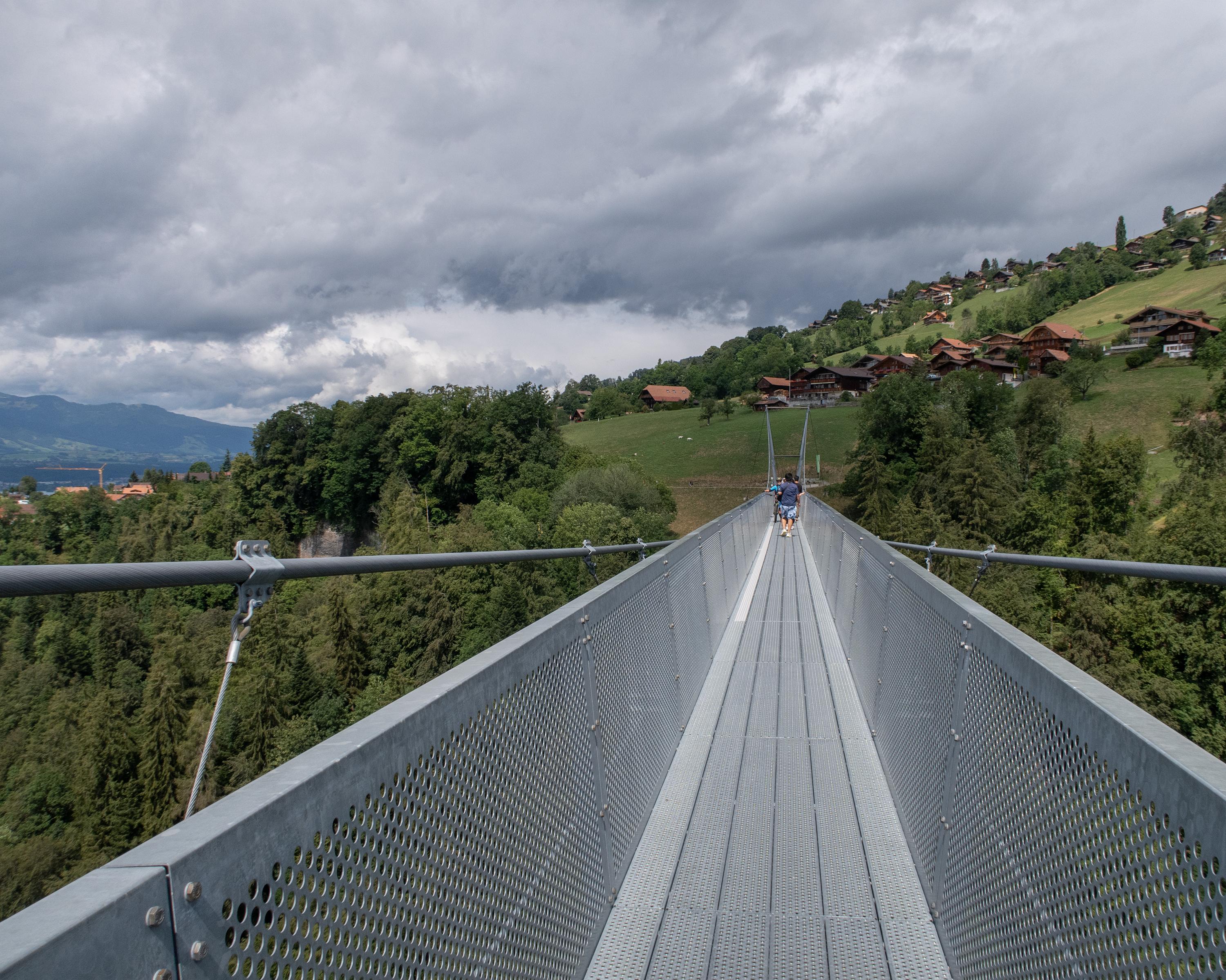
Starting in the historical town of Thun with its mediaeval castle, the hike takes you past a number of idyllic places including Hünibach and Aeschlen, shortly before you reach the spectacular Sigriswil bridge with its panoramic views high above Lake Thun.

Height profile

Weather:

Comments about this activity or place?

Thank you for your feedback!