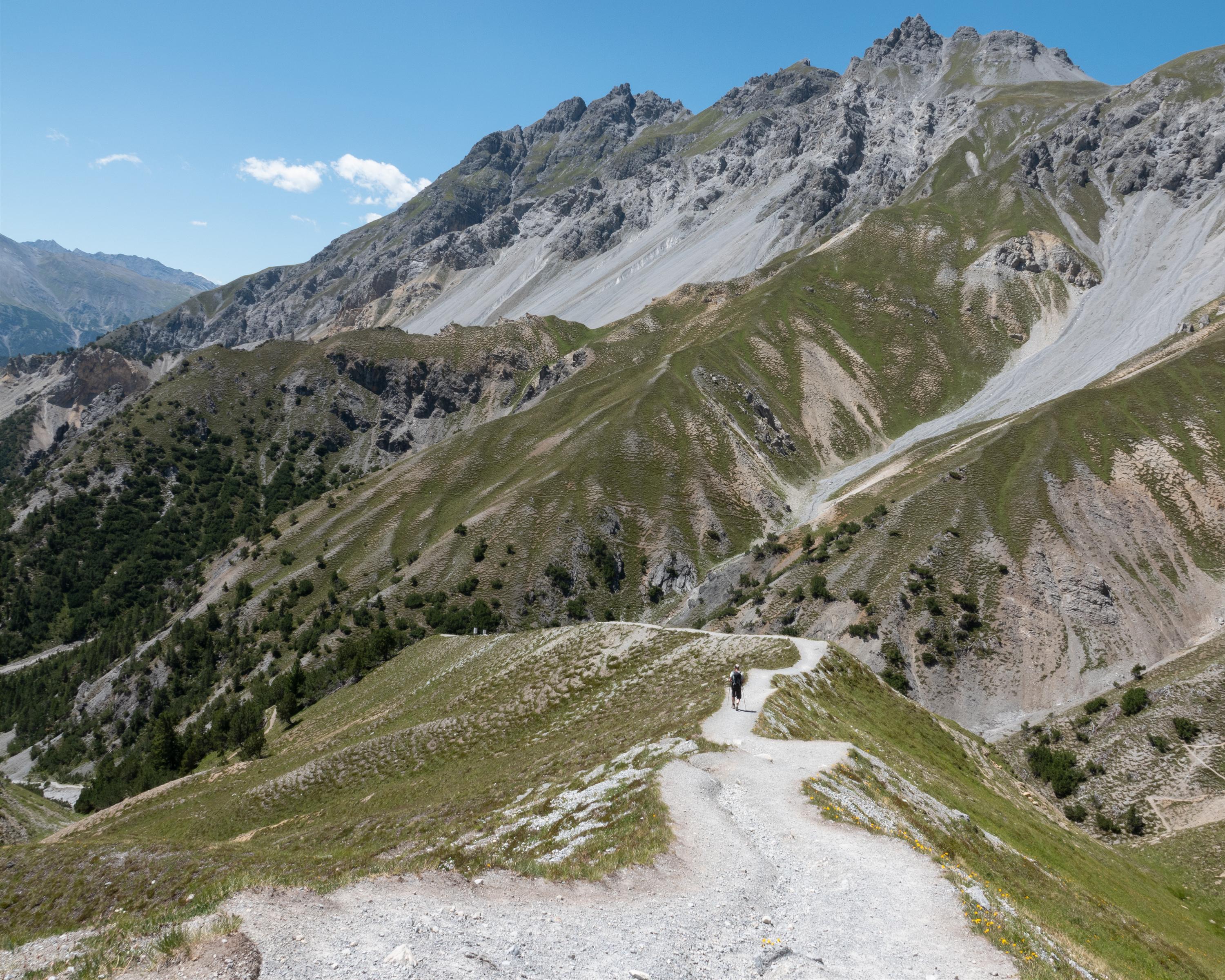
Local route No. 812, Stage 2: Stabelchod (P8) – Il Fuorn
Description
Local route
No. 812
Length
8 km
Ascent • Descent
↑ 500 m • ↓ 600 m
Lowest point • Highest point
1793 m • 2331 m
Hiking time
2 h 50 min
Grade
medium
Fitness level
medium
From the Ofen Pass forests to the high alpine meadows with rich flora and fauna and magnificent views over half of the National Park. The nature trail provides interesting information about its open and hidden secrets along the way.

..Il+Fuorn&freizeit=1&noweather=1&width=400&height=200&x_axis_display=distance&polyline=s_tp%40c%60nI%7BtB%3FuBsAAcDiC%7D%40AyCyAmCGiD%7BAmBEqCsCe%40I%7DC%7BCQMaDqCNKyCaCrAQaDaDe%40OiDiCk%40KqCoC%7B%40M%7DCoCi%40MyCmCu%40Q_DkBoBOcDg%40%7BCScDi%40gCOoCI_DQcDlAI%5D%7BCXeAc%40eDEs%40%5DwClB%7DAe%40%7DC%7D%40uB%5D%7DCHaB_%40%7BC%7B%40%7DB%5BaDcAgB_%40kDQeAYiCkBeCUmD%5BeCBqCo%40qBL_D%5BkCHyC_%40%7D%40%40%7BCoBiBGkDkAeBIwCo%40%7BCg%40eDg%40aCe%40mCrBCi%40%7DCdCMu%40_DaAeCa%40%7BCrCh%40g%40_D%7E%40%7BBa%40%7BCl%40wB%5B_DrAcBa%40aDvBuAYyCE_CIeDFgC%40yCi%40kC%3F%7BClBm%40DkDjCGb%40mCvCU%60%40_DxCn%40j%40cD%60BVh%40yCsAvAb%40cD%60Bd%40ZyC%60A%5Ed%40wC%60Ax%40j%40cDpAKXyCvAbC%5EaDvBtBZiDl%40zBPqCx%40tC%60%40mDtAnBVoChBvBZaDdBfBTsCz%40tCNcD%7E%40fCPwCj%40vCTaDh%40zCVcDd%40rCT%7DCj%40xCRaDTjCPqC%60BzCNwDx%40%7CBPkCd%40%7CCRcDrAfCRaDt%40bCPoCrAlCTiDrBjANmCnChAReDhBdBTyCfBrBP%7DCl%40dDPmDd%40fCNmCj%40xCL_DhB%7E%40NmDbCs%40DmCZh%40VwCjAJHcDrCTA%7BChBOMcDvAP%40aDfCe%40NsCjCu%40N%7BCzCa%40TeDnCg%40H%7DCbCs%40HwCvC_ARmDjC%5D%40mChBgBT%7DCtDoAHgEnBQBoB)