DE
FR
IT
EN
Directory
Weather
Map / Route
Timetable
Leisure
TV guide
Cinema
Web search
Apps
More
Personal Data »
Login:
Register
Password forgotten
or
Log in with local.ch
Log in with Apple
Log in with Facebook
Log in with Google
Log in with LinkedIn
Please note that our new
privacy statement
as well as the revised
terms and conditions of use
apply.
Leisure
Hike
Ofenloch-Weg
Local route No. 948, Schwägalp–Ennetbühl
Description
Local route
No. 948 (Schwägalp–Ennetbühl)
Length
15 km
Ascent • Descent
↑ 720 m • ↓ 1200 m
Lowest point • Highest point
884 m • 1524 m
Hiking time
5 h
Grade
medium (mountain hiking trail)
Fitness level
difficult
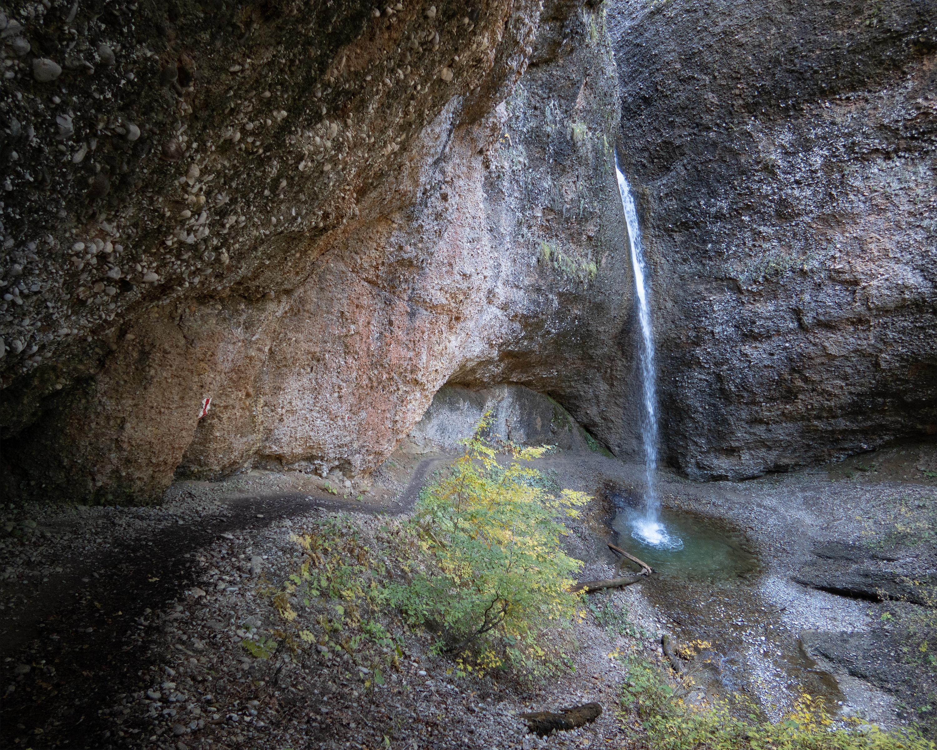
The tour takes you to Eastern Switzerland's Grand Canyon, the Ofenloch. This spectacular gorge is an insiders' tip for hikers and explorers, due to its remote location between Neckertal and Toggenburg.
Booking Information
E-mail:
info@toggenburg.swiss
Comments on this information?
We welcome your feedback!
Presented by
Route
Height profile
Weather:
More...
Toggenburg Tourismus
Hauptstrasse 104, 9658 Wildhaus
Toggenburg Tourismus
Hauptstrasse 104, 9658 Wildhaus
071 999 99 11
Comments about this activity or place?
Incorrect information
Missing information
Another topic
Thank you for your feedback!
Close