search.ch

ViaJacobi

National route No. 4, Interlaken–Spiez
  • Image 1

Description

National route
No. 4 (Interlaken–Spiez)
Length
13 km
Ascent • Descent
↑ 420 m • ↓ 440 m
Lowest point • Highest point
558 m • 727 m
Hiking time
3 h 45 min
Grade
easy (hiking trail)
Fitness level
medium
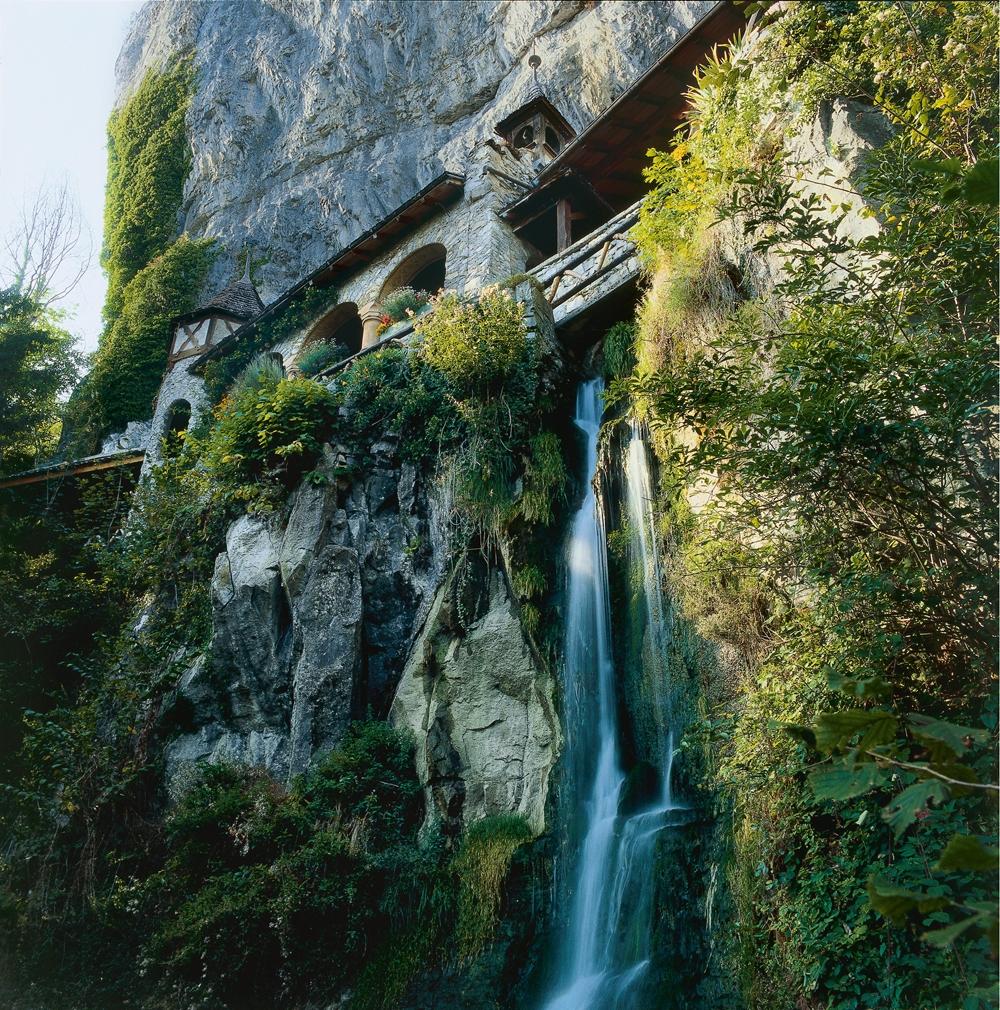
The section leads alongside the River Aare to the Weissenau nature reserve on the Thunersee lake. From Neuhaus it continues through woodland, often with clear views of the lake and the Bernese Alps. The Beatushöhlen (caves), former place of pilgrimage of St. Beatus are particularly impressive.

Height profile

Weather:

Comments about this activity or place?

Thank you for your feedback!