search.ch

Via Alpina, Stage 11/20

National route No. 1, Stage 11: Grindelwald – Lauterbrunnen
  • Image 1

Description

National route
No. 1 (Vaduz – Montreux)
Length
20 km
Ascent • Descent
↑ 1150 m • ↓ 1400 m
Lowest point • Highest point
777 m • 2062 m
Hiking time
6 h 40 min
Grade
easy
Fitness level
difficult
National route No. 1: Via Alpina
Stages
0. Weisstannen – Elm
0. Gstaad – L'Etivaz
0. L'Etivaz – Rossinière
0. Elm – Linthal
0. Urner Boden – Altdorf (UR)
0. Lauterbrunnen – Griesalp
0. Sargans – Weisstannen
0. Altdorf (UR) – Engelberg
0. Rochers de Naye – Montreux
0. Lenk – Gstaad
0. Kandersteg – Adelboden
0. Engelberg – Engstlenalp
0. Adelboden – Lenk
0. Grindelwald – Lauterbrunnen
0. Rossinière – Rochers de Naye
0. Meiringen – Grindelwald
0. Griesalp – Kandersteg
0. Engstlenalp – Meiringen
0. Vaduz (Gaflei, FL) – Sargans
0. Linthal – Urner Boden
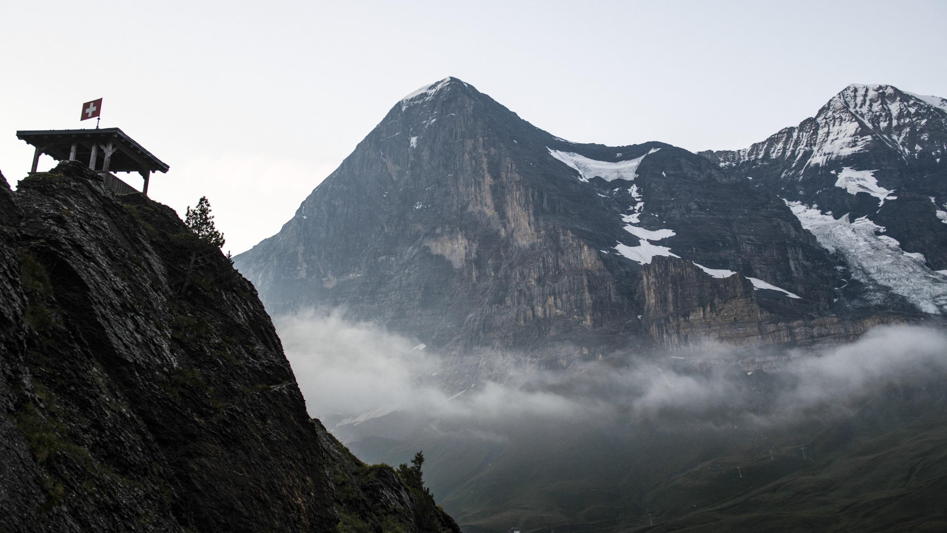
The climb to Kleine Scheidegg over undulating meadows is gentle, the rock and ice scenery of the Eiger North Wall close and awe-inspiring. Sunny high-level trail to Wengen, then deep into the Lauterbrunnen Valley with its vertical walls and spectacular waterfalls.

Height profile

Weather:

Comments about this activity or place?

Thank you for your feedback!