DE
FR
IT
EN
Directory
Weather
Map / Route
Timetable
Leisure
TV guide
Cinema
Snow
Web search
Apps
More
Personal Data »
Login:
Register
Password forgotten
or
Log in with local.ch
Log in with Apple
Log in with Facebook
Log in with Google
Log in with LinkedIn
Please note that our new
privacy statement
as well as the revised
terms and conditions of use
apply.
Leisure
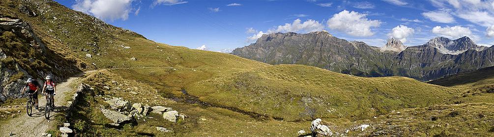
Mountain bike in Safien-Platz
Alpine Bike, Stage 7/16
National route No. 1, Stage 7: Safien Platz – Lumbrein
Description
National route
No. 1 (Scuol – Leysin)
Length
49 km
Ascent • Descent
↑ 1900 m • ↓ 1800 m
Lowest point • Highest point
862 m • 2412 m
Grade
difficult
Fitness level
difficult
National route No. 1:
Alpine Bike
Stages
0. Adelboden – Zweisimmen
0. Interlaken – Adelboden
0. Meiringen – Grindelwald
0. Château-d'Oex – Leysin
0. Tiefencastel – Safien Platz
0. Tschierv – Livigno (I)
0. St. Moritz – Bivio
0. Lumbrein – Disentis
0. Safien Platz – Lumbrein
0. Disentis – Andermatt
0. Zweisimmen – Château-d'Oex
0. Bivio – Tiefencastel
0. Andermatt – Meiringen
0. Grindelwald – Interlaken
0. Scuol – Tschierv
0. Livigno (I) – St. Moritz
Biking in the tracks of the Walser settlers: easy start through mystic Safiental, steep ascent on the «Polenweg» to the Tomülpass, a biking highlight, great descent to Vals. And to finish, a peaceful pedal in the remote Val Lumnezia.
Comments on this information?
We welcome your feedback!
Presented by
Route
Height profile
Weather:
More...
Comments about this activity or place?
Incorrect information
Missing information
Another topic
Thank you for your feedback!
Close