DE
FR
IT
EN
Directory
Weather
Map / Route
Timetable
Leisure
TV guide
Cinema
Web search
Apps
More
Personal Data »
Login:
Register
Password forgotten
or
Log in with local.ch
Log in with Apple
Log in with Facebook
Log in with Google
Log in with LinkedIn
Please note that our new
privacy statement
as well as the revised
terms and conditions of use
apply.
Leisure
Hike in Zurich Region
Stammertal Rundweg
Accessible route No. 895, Stammheim–Stammheim
Description
Accessible route
No. 895 (Stammheim–Stammheim)
Length
12 km
Ascent • Descent
↑ 180 m • ↓ 180 m
Lowest point • Highest point
418 m • 490 m
Hiking time
3 h
Grade
medium (for wheelchair users)
Fitness level
difficult (for wheelchair users)
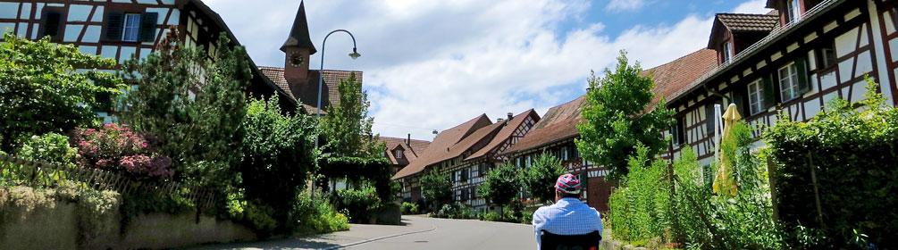
This route leads from Oberstammheim to the Schwandegg and Girsberg Castles and back again. This particularly well-kept landscape with it's romantic timber-framed buildings and historic aspects is always well worth a visit.
Booking Information
E-mail:
tourismus@procap.ch
Comments on this information?
We welcome your feedback!
Presented by
Route
Height profile
Weather:
More...
Procap Reisen & Sport
Frohburgstrasse 4, 4600 Olten
Procap Reisen & Sport
Frohburgstrasse 4, 4600 Olten
062 206 88 30
Comments about this activity or place?
Incorrect information
Missing information
Another topic
Thank you for your feedback!
Close