DE
FR
IT
EN
Directory
Weather
Map / Route
Timetable
Leisure
TV guide
Cinema
Snow
Web search
Apps
More
Personal Data »
Login:
Register
Password forgotten
or
Log in with local.ch
Log in with Apple
Log in with Facebook
Log in with Google
Log in with LinkedIn
Please note that our new
privacy statement
as well as the revised
terms and conditions of use
apply.
Leisure
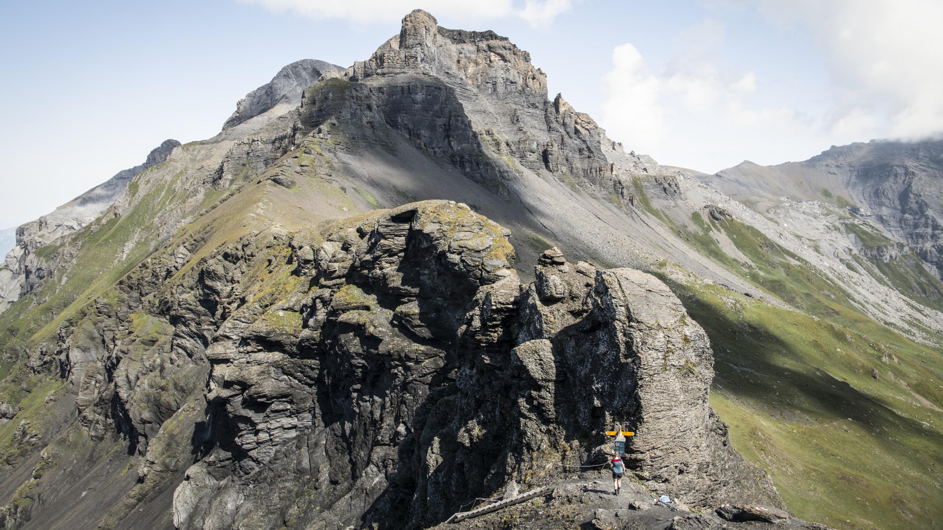
Hike in Kiental
Hohtürli, Stage 13/20
National route No. 1, Stage 13: Griesalp – Kandersteg
Description
National route
No. 1 (Vaduz – Montreux)
Length
17 km
Ascent • Descent
↑ 1450 m • ↓ 1700 m
Lowest point • Highest point
1171 m • 2791 m
Hiking time
7 h 15 min
Grade
medium
Fitness level
difficult
National route No. 1:
Via Alpina
Stages
0. Linthal – Urner Boden
0. Altdorf (UR) – Engelberg
0. Rochers de Naye – Montreux
0. Engstlenalp – Meiringen
0. Lauterbrunnen – Griesalp
0. Vaduz (Gaflei, FL) – Sargans
0. Grindelwald – Lauterbrunnen
0. Elm – Linthal
0. Lenk – Gstaad
0. Sargans – Weisstannen
0. Griesalp – Kandersteg
0. Rossinière – Rochers de Naye
0. L'Etivaz – Rossinière
0. Kandersteg – Adelboden
0. Weisstannen – Elm
0. Gstaad – L'Etivaz
0. Urner Boden – Altdorf (UR)
0. Meiringen – Grindelwald
0. Adelboden – Lenk
0. Engelberg – Engstlenalp
The king’s stage over the 2778m-high Hohtürli. Rewarding detour to the Blümlisalphütte and eternal glacier ice. Down over moraine to beautiful, deep-blue Oeschinensee backed by steep cliffs; one of the most beautiful mountain lakes in the Alps.
Comments on this information?
We welcome your feedback!
Presented by
Route
Height profile
Weather:
More...
Comments about this activity or place?
Incorrect information
Missing information
Another topic
Thank you for your feedback!
Close