search.ch

ViaJura

Regional route No. 80, Sornetan–Sonceboz
  • Image 1

Description

Regional route
No. 80 (Sornetan–Sonceboz)
Length
15 km
Ascent • Descent
↑ 420 m • ↓ 620 m
Lowest point • Highest point
643 m • 1010 m
Hiking time
4 h 10 min
Grade
easy (hiking trail)
Fitness level
medium
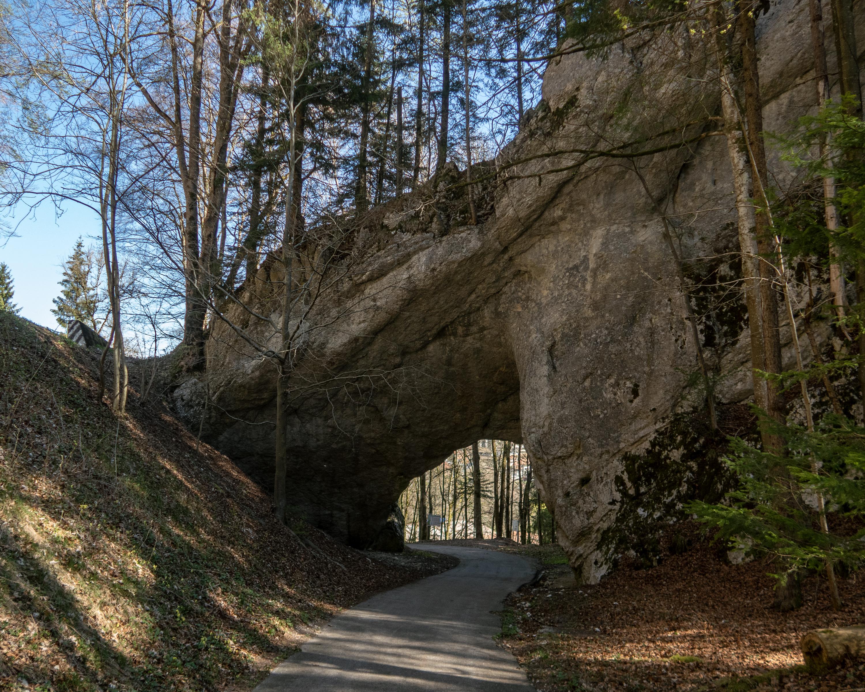
The gentle descent through the wooded, hilly Jura landscape with its impressive old trees leads past ponds, moorlands, extensive pastures and avenues of trees. Behind Tavannes, the route passes through a natural rock passage already used by the Romans.

Height profile

Weather:

Comments about this activity or place?

Thank you for your feedback!