DE
FR
IT
EN
Directory
Weather
Map / Route
Timetable
Leisure
TV guide
Cinema
Snow
Web search
Apps
More
Personal Data »
Login:
Register
Password forgotten
or
Log in with local.ch
Log in with Apple
Log in with Facebook
Log in with Google
Log in with LinkedIn
Please note that our new
privacy statement
as well as the revised
terms and conditions of use
apply.
Leisure
Hike in Vaud
Jura Crest Trail, Stage 13/16
National route No. 5, Stage 13: Ballaigues – Le Pont
Description
National route
No. 5 (Dielsdorf – Nyon)
Length
18 km
Ascent • Descent
↑ 900 m • ↓ 760 m
Lowest point • Highest point
743 m • 1483 m
Hiking time
5 h 35 min
Grade
easy
Fitness level
difficult
National route No. 5:
Jura Crest Trail
Stages
0. Les Rochats – Ste-Croix
0. Weissenstein – Frinvillier
0. Balsthal – Weissenstein
0. Ballaigues – Le Pont
0. Col du Marchairuz – St-Cergue
0. Ste-Croix – Ballaigues
0. Staffelegg – Hauenstein
0. Vue des Alpes – Noiraigue
0. Noiraigue – Les Rochats
0. Frinvillier – Chasseral
0. Le Pont – Col du Marchairuz
0. Brugg AG – Staffelegg
0. Hauenstein – Balsthal
0. Chasseral – Vue des Alpes
0. St-Cergue – Nyon
0. Dielsdorf – Brugg
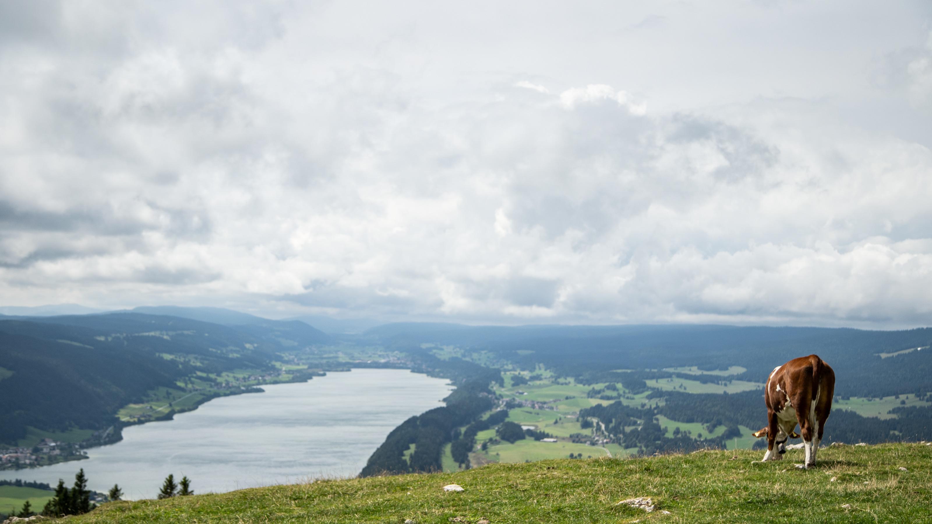
Typical Jura: fa river, its spring in a nearby grotto, then a hike along a mountain with wonderful views and lastly two lakes with no visible outlets. So characteristic of the Vallée de Joux, cradle of many world-renowned luxury watches.
Comments on this information?
We welcome your feedback!
Presented by
Route
Height profile
Weather:
More...
Comments about this activity or place?
Incorrect information
Missing information
Another topic
Thank you for your feedback!
Close