DE
FR
IT
EN
Directory
Weather
Map / Route
Timetable
Leisure
TV guide
Cinema
Snow
Web search
Apps
More
Personal Data »
Login:
Register
Password forgotten
or
Log in with local.ch
Log in with Apple
Log in with Facebook
Log in with Google
Log in with LinkedIn
Please note that our new
privacy statement
as well as the revised
terms and conditions of use
apply.
Leisure
Hike in Graubünden
ViaValtellina, Stage 1/8
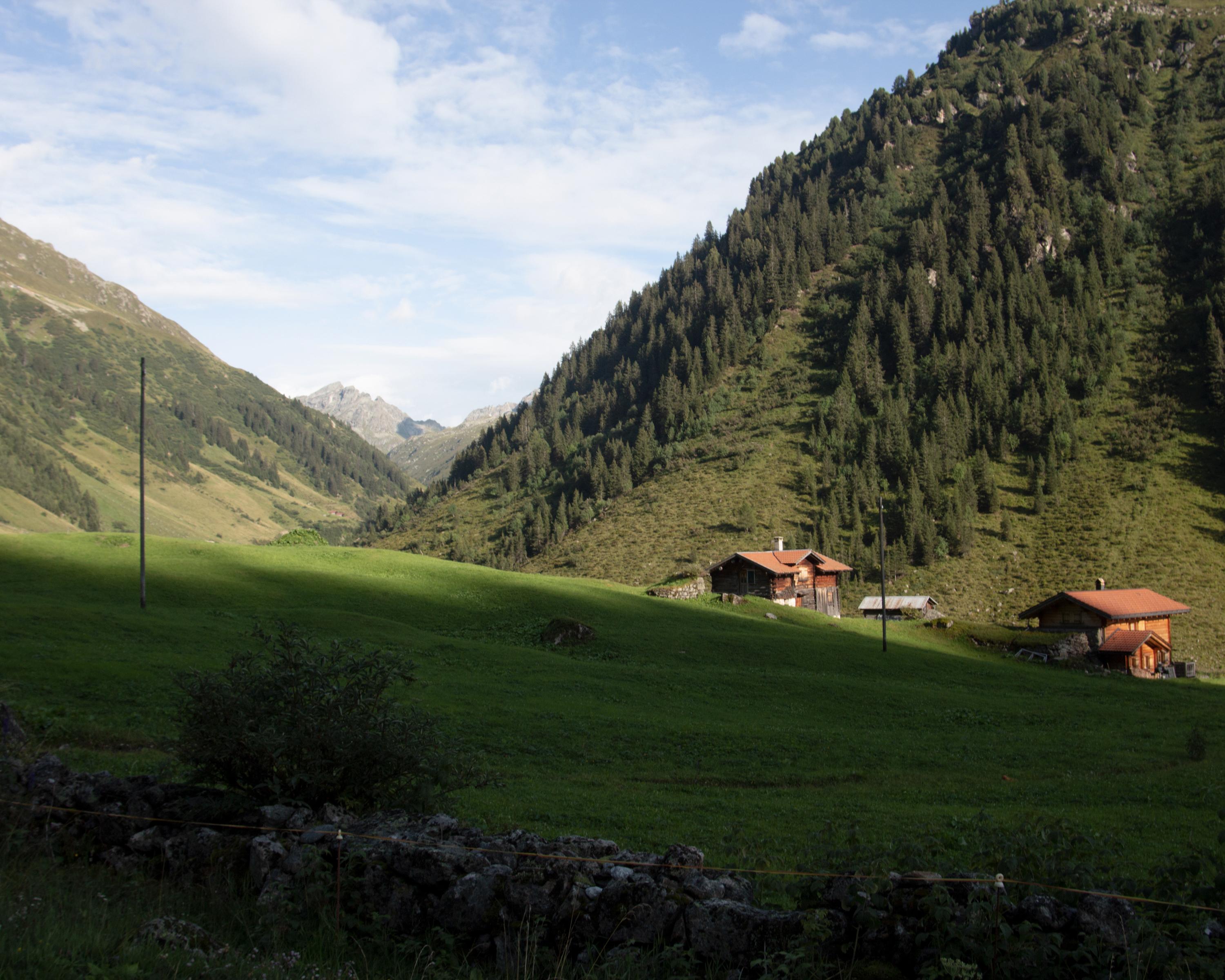
Regional route No. 30, Stage 2: Gargellen (A) – Klosters (Schlappin)
Description
Regional route
No. 30 (Gargellen (A) – Tirano (I))
Length
9 km
Ascent • Descent
↑ 840 m • ↓ 580 m
Lowest point • Highest point
1422 m • 2202 m
Hiking time
4 h
Grade
medium
Fitness level
medium
Regional route No. 30:
ViaValtellina
Stages
0. Klosters – Davos
0. Gargellen (A) – Klosters (Schlappin)
0. Davos – S-chanf
0. Pontresina – Ospizio Bernina
0. S-chanf – Pontresina
0. San Romerio – Tirano (I)
0. Poschiavo – San Romerio
0. Ospizio Bernina – Poschiavo
From Montafon over the Alpine pastures of Valzifenz and the 2202m-high Schlappiner Joch to the former Walser settlement of Schlappin in Prättigau. Interesting introduction to the history of Montafon in the Schruns Local History Museum.
Comments on this information?
We welcome your feedback!
Presented by
Route
Height profile
Weather:
More...
Comments about this activity or place?
Incorrect information
Missing information
Another topic
Thank you for your feedback!
Close

..Klosters+(Schlappin)&freizeit=1&noweather=1&width=400&height=200&x_axis_display=distance&polyline=unco%40igoK%7BwA%3FDxEO%7DEHtCGwCDjDSoDL%7EEOaFz%40pFYyFr%40fAKwAr%40pBQkDVbC%5DgEm%40bBYmD%60BbCUeDf%40%7EDUiEVzDC%7DDm%40xC%40kD_ApDMeEfBhBSeDH%60DWgDn%40hEYqEQ%7CCKcDtBhD%5DsEzArBKwC%60ArCQqDhBfC%5BwDvAjCYuD%60C%60CI%7BDv%40%7CBKmDkFDGmFp%40lD%5DsDbArBSgCzA%60E_%40uEr%40dD%5BoDrAfCK_D%60ArEYcF%3FnDUoDMfCMgCIdESgEgAbDQsDgA%7CDGiEqA%60D%40uDuAhCAcDY%7EDCcEFzEG%7BEMtCEuCIvCGyCSlDIoDqBzCKcE%7BAzCQuDSfDOiD%7B%40vDGcEo%40%7CCEiDj%40%7ECIsDxAlCOyDr%40dDQwDjA%60Bo%40wDBzB_%40wDb%40nAi%40sD%7CBWc%40aEfA%7DA_%40iDS%7CCk%40uDN%7CDk%40uEj%40pB%5B_DRxAi%40kDX%7CAo%40_EChAi%40_E%60At%40e%40iDz%40nBi%40gEnANc%40%7BC%60Aj%40k%40%7BDxAd%40%5BeEcAbCSaDi%40n%40m%40gEl%40%7ECa%40iD%7EAtCLuDbAvCd%40%7BDp%40fCd%40oDbBxC%60%40iEt%40tCZeD%7EBrAVqDpCdBXwDlCnB%60%40wDoBd%40n%40wDAjAh%40sDfArBr%40cE_Ct%40ZoDsAbB%60%40mDoCfBv%40_E%7BChAx%40qDkApBl%40oD%60ApBj%40%7BDfChBh%40sDJjCj%40yD_CzBj%40uDc%40bBp%40sDnCpAr%40sDtBf%40h%40uDbCIr%40wD%40jDn%40yDvA%7EB%60%40yDlCvANqDlAhCBwDhCbBBoD)