DE
FR
IT
EN
Directory
Weather
Map / Route
Timetable
Leisure
TV guide
Cinema
Snow
Web search
Apps
More
Personal Data »
Login:
Register
Password forgotten
or
Log in with local.ch
Log in with Apple
Log in with Facebook
Log in with Google
Log in with LinkedIn
Please note that our new
privacy statement
as well as the revised
terms and conditions of use
apply.
Leisure
Hike in Bellinzona
ViaGottardo, Stage 16/20
National route No. 7, Stage 16: Bellinzona – Tesserete
Description
National route
No. 7 (Basel – Chiasso)
Length
23 km
Ascent • Descent
↑ 1250 m • ↓ 950 m
Lowest point • Highest point
222 m • 1016 m
Hiking time
7 h 35 min
Grade
medium
Fitness level
difficult
National route No. 7:
ViaGottardo
Stages
0. Luzern – Altdorf
0. Airolo – Rodi
0. Biasca – Bellinzona
0. Liestal – Läufelfingen
0. Läufelfingen – Olten
0. Wassen – Andermatt
0. Mendrisio – Chiasso
0. Gotthardpass – Airolo
0. Rodi – Lavorgo
0. Altdorf – Wassen
0. Andermatt – Gotthardpass
0. Basel – Liestal
0. Lugano (Paradiso) – Morcote
0. Sursee – Luzern
0. Lavorgo – Biasca
0. Zofingen – Sursee
0. Olten – Zofingen
0. Morcote – Mendrisio
0. Tesserete – Lugano (Comano)
0. Bellinzona – Tesserete
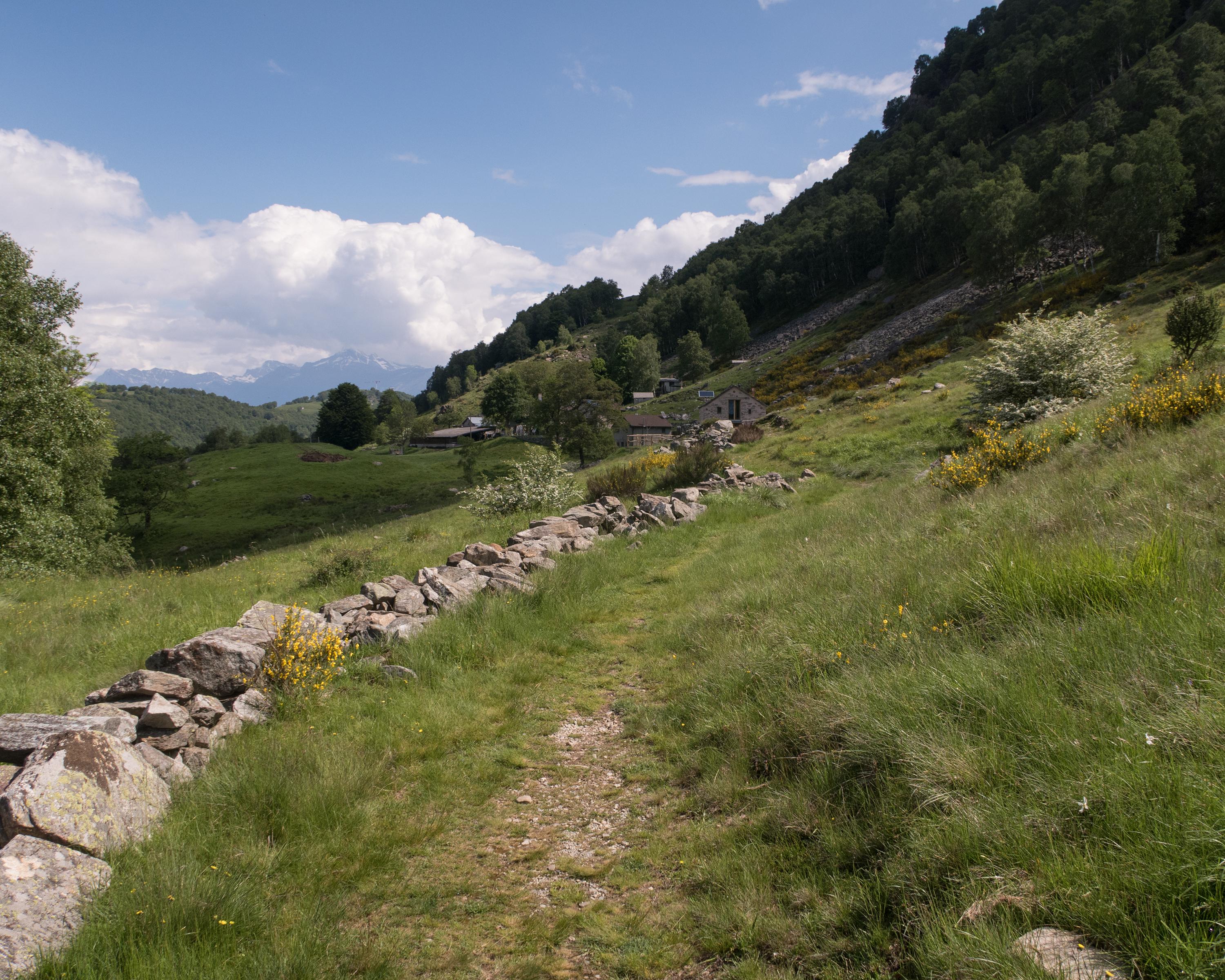
Varied and pleasant paths lead through forests, past dry stone walls and over many small streams. Nature dominates here on the pass from Sopra to Sottoceneri. Along old trails and mule tracks, you reach Tesserete.
Comments on this information?
We welcome your feedback!
Presented by
Route
Height profile
Weather:
More...
Comments about this activity or place?
Incorrect information
Missing information
Another topic
Thank you for your feedback!
Close