DE
FR
IT
EN
Directory
Weather
Map / Route
Timetable
Leisure
TV guide
Cinema
Snow
Web search
Apps
More
Personal Data »
Login:
Register
Password forgotten
or
Log in with local.ch
Log in with Apple
Log in with Facebook
Log in with Google
Log in with LinkedIn
Please note that our new
privacy statement
as well as the revised
terms and conditions of use
apply.
Leisure
Hike in Chur
Alpine Passes Trail
National route No. 6, St. Moritz, Corviglia – St-Gingolph
Description
National route
No. 6 (St. Moritz, Corviglia – St-Gingolph)
Length
695 km
Ascent • Descent
↑ 47100 m • ↓ 49200 m
Lowest point • Highest point
374 m • 2987 m
Grade
medium
Fitness level
difficult
National route No. 6: Alpine Passes Trail
Stages
0. St. Moritz, Corviglia – Jenatschhütte SAC
0. Jenatschhütte SAC – Sur GR, Alp Flix
0. Sur GR, Alp Flix – Savognin
0. Savognin – Ausserferrera
0. Ausserferrera – Splügen
0. Splügen – Turra
0. Turra – Vella
0. Vella – Vrin
0. Vrin – Cap. Scaletta
0. Cap. Scaletta – Cap. Bovarina
0. Cap. Bovarina – Cap. Cadagno
0. Cap. Cadagno – Airolo
0. Airolo – Cap. Corno-Gries
0. Cap. Corno-Gries – Rif. Margaroli
0. Rif. Margaroli – Binn
0. Binn – Rosswald
0. Rosswald – Simplon Hospiz
0. Simplon Hospiz – Gspon
0. Gspon – Saas Fee
0. Saas Fee – Grächen
0. Grächen – Gruben
0. Gruben – Hotel Weisshorn
0. Hotel Weisshorn – Grimentz
0. Grimentz – Cab. des Becs de Bosson
0. Cab. des Becs de Bosson – Evolène
0. Evolène – Arolla
0. Arolla – Cab. des Dix
0. Cab. des Dix – Cab. de Prafleuri
0. Cab. de Prafleuri – Cab. de Louvie
0. Cab. de Louvie – Mauvoisin
0. Mauvoisin – Cab. de Brunet
0. Cab. de Brunet – Bourg-St-Pierre
0. Bourg-St-Pierre – Col du Gd St-Bernard
0. Col du Gd St-Bernard – La Fouly
0. La Fouly – Champex-Lac
0. Champex – Trient
0. Trient – Lac d’Emosson
0. Lac d’Emosson – Cab. de Salanfe
0. Cab. de Salanfe – Barme
0. Barme – Morgins
0. Morgins – Torgon
0. Torgon – Taney
0. Taney – St-Gingolph
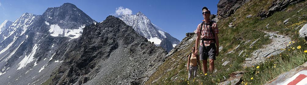
The Alpine Passes Trail strings together many of the most beautiful passes in the Graubunden and Valais Alps in 43 stages. One highlight follows another from the Greina Plateau to the passes and lake landscape at the foot of the Dents du Midi.
Comments on this information?
We welcome your feedback!
Presented by
Route
Height profile
Weather:
More...
Comments about this activity or place?
Incorrect information
Missing information
Another topic
Thank you for your feedback!
Close