DE
FR
IT
EN
Directory
Weather
Map / Route
Timetable
Leisure
TV guide
Cinema
Snow
Web search
Apps
More
Personal Data »
Login:
Register
Password forgotten
or
Log in with local.ch
Log in with Apple
Log in with Facebook
Log in with Google
Log in with LinkedIn
Please note that our new
privacy statement
as well as the revised
terms and conditions of use
apply.
Leisure
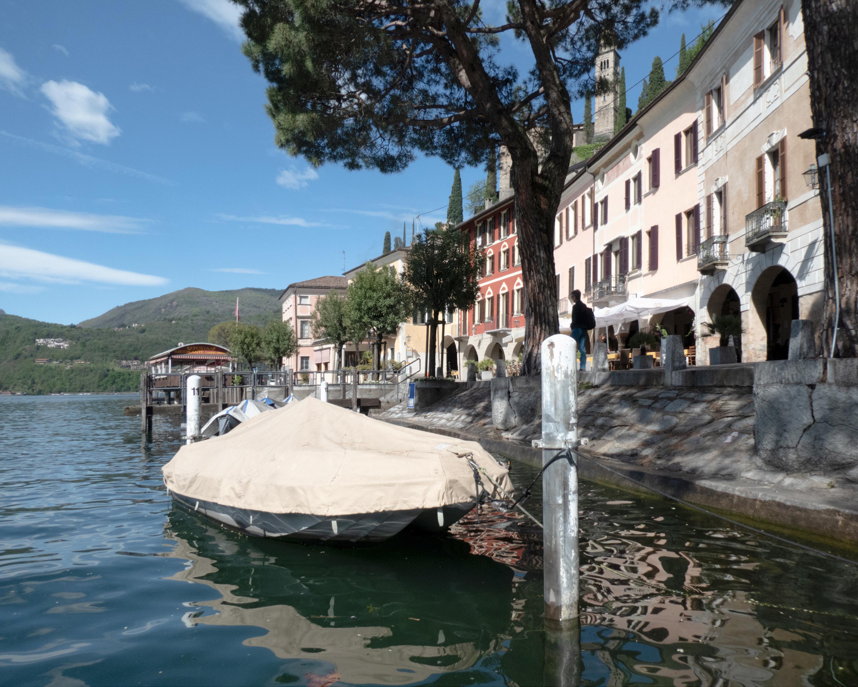
Hike in Lake Lugano
Sentiero Lago di Lugano, Stage 7/9
Regional route No. 52, Stage 7: Lugano (Paradiso) – Morcote
Description
Regional route
No. 52 (Lugano (Magliaso) – Mendrisio)
Length
12 km
Ascent • Descent
↑ 840 m • ↓ 880 m
Lowest point • Highest point
272 m • 892 m
Hiking time
4 h 30 min
Grade
medium
Fitness level
medium
Regional route No. 52:
Sentiero Lago di Lugano
Stages
0. Lugano (Magliaso) – Miglieglia
0. Miglieglia – Cap. Tamaro
0. Cap. Tamaro – Medeglia
0. Medeglia – Cap. M. Bar
0. Lugano (Paradiso) – Morcote
0. Riva S. Vitale (M. Generoso) – Mendrisio
0. Cap. M. Bar – Cap. Pairolo
0. Morcote – Riva S. Vitale (Capolago)
0. Cap. Pairolo – Lugano (M. Brè)
The hike from Monte San Salvatore to Vico Morcote is a classic for the whole family. Always slightly downhill, woodlands alternating with well-kept villages, pretty grotti and scenic views.
Comments on this information?
We welcome your feedback!
Presented by
Route
Height profile
Weather:
More...
Comments about this activity or place?
Incorrect information
Missing information
Another topic
Thank you for your feedback!
Close

..Morcote&freizeit=1&noweather=1&width=400&height=200&x_axis_display=distance&polyline=%7Bdwj%40__wDqQ%3FL%60F%5D%7DFiBfEo%40wFBlEu%40wFpE%5Cq%40wFxApDq%40yFYvFmA%7BFkAhD_AqFiFyAw%40%7BFoFm%40%7B%40wFkBrA%7D%40eGqA%7C%40%7D%40iFeFxBcAeGw%40hCk%40oFz%40z%40y%40sFhD%7DAy%40wFw%40dFcA%7DFjD%7DAo%40_HjBr%40q%40oEgAlE%5BkG%5CrEFeFpDrDg%40eGlDrDY%7BFpBpDi%40aFeALm%40yFxCjDH%7BFdDtAb%40sF%5EdCx%40mGvASv%40iFpBxCn%40wFf%40%60Dl%40%7BFq%40jDp%40wFbAhBf%40uF%7CC%7EBt%40%7BFzAlBn%40oFDdFj%40%7DFAhFT%7DFr%40%7CE%5EmGlAhER_FKrFA_GpC%7CBUmFvDpCN%7BFxApENaGlDpCCqFnDjC%3FsFjEvCT_G%60DbETcGJnEQaFzDnCWuFf%40lFU_GTjFMcGgDpCIgGwB%7EDBgFsAlEBeGrDzBI_FE%7EEB_GkDjBWqFu%40bFQuFNxFW%7BFzA%7ECSyFx%40Z_%40sFdAdBc%40yGjBjECgFnBzEIwFdClECyFbDhCa%40iFvBdD%5BwFvB%7EDMwFjBnEYwF%7ECbEYcGzCzDSyFJdF%3FiFlClEHoGdA%60ED_F_%40dGH%7DGnCnDNeFfC%7CDPsFfCrE%5EcGlCrDZgFxAbF%5CuFtDrD%5CeG%7CEn%40XeF%60DyCPyF%7CCqCV%7BFQtFPwFxCdD%60%40yFf%40fFb%40_GmEdBLkFnBjFv%40iGDlE%60%40iF%5BvEv%40uFnAjDtA%7DFeAzEl%40yFtA%7EDH%7BFsA%7CDNwFe%40tEfAoF%7DBhAhBwFpAdC%7C%40yFq%40zBzAwFoEIf%40_GuEy%40%3FoF)