Local route No. 375, Stage 5: Rosenlaui (Chaltenbrunnen) – Zwirgi
Description
Local route
No. 375
Length
14 km
Ascent • Descent
↑ 880 m • ↓ 1100 m
Lowest point • Highest point
867 m • 1874 m
Hiking time
5 h
Grade
medium
Fitness level
difficult
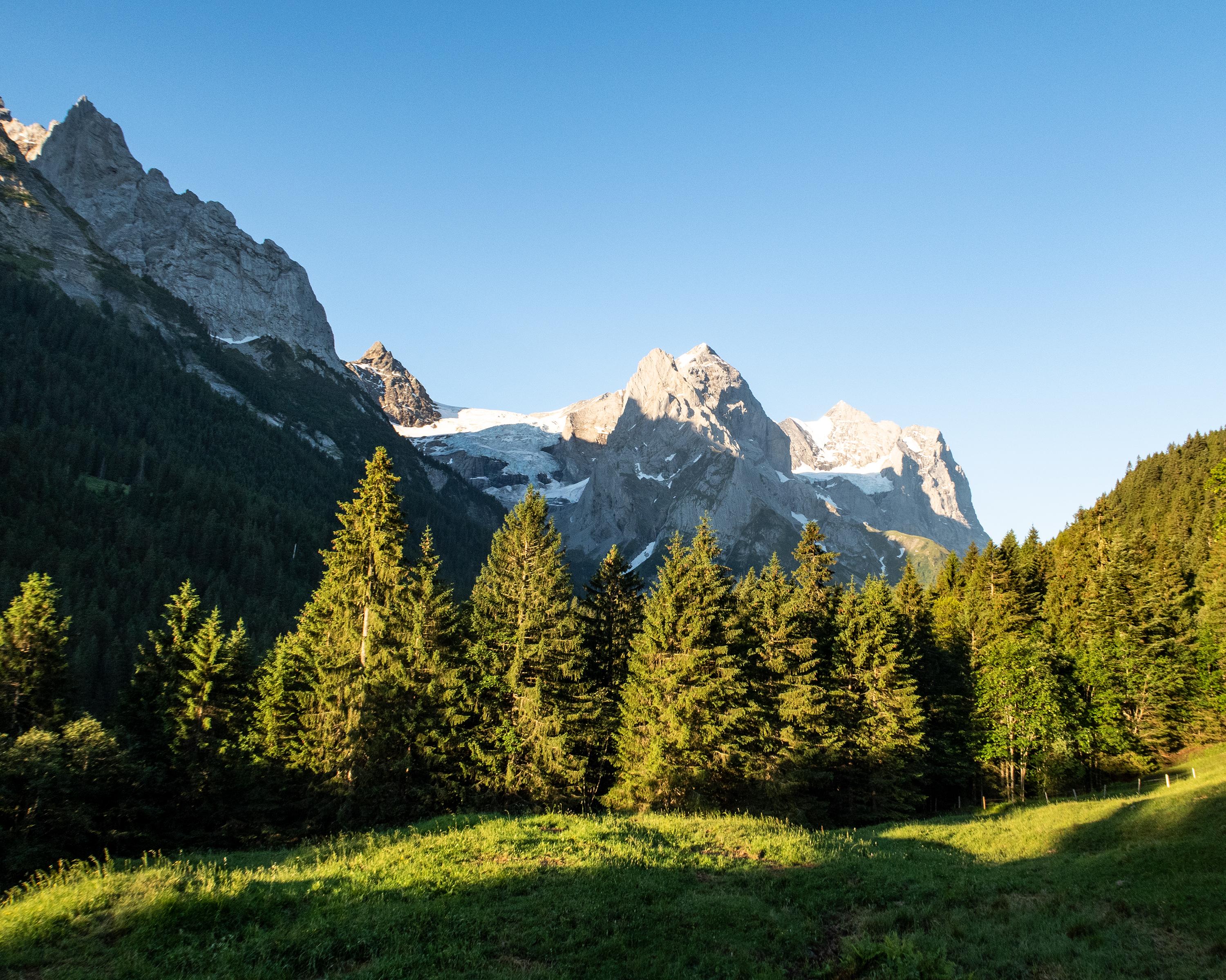
An attractive circular hike to the most elevated high moor in Europe with countless small ponds and little lakes. The hike is distinguished by a magnificent view of the Hasliberg and the final crescendo at the Reichenbach waterfall.

..Zwirgi&freizeit=1&noweather=1&width=400&height=200&x_axis_display=distance&polyline=wq%60g%40omoIojA%3FpCpESeHxB%7EDKmGxFFi%40sHiBcDe%40yFPuCe%40uGxCc%40s%40sGaDiFq%40iHc%40yFk%40aGzAmCo%40gHbC%7CEe%40cG%60Fp%40k%40yGjGh%40YyGdF%7CAe%40wGzEwAc%40%7DGjEuDQsGxCuDg%40iGm%40kEg%40%7BGbByB%5BsG%60F%7DBg%40uGsBkFe%40uG%60%40_Gg%40%7DGzEgDo%40wGnDAm%40mGvC%60Bc%40%7DGpBsCWmG%7EEqCk%40yGrGM%7B%40%7BGKaFs%40sGfD%7DEYyGrDkESqGhGIMyGnGHg%40_HhE%7BBy%40sGzE_ACsGzGu%40AeHfFkA%5D%7DFzGj%40m%40gHtEjCHeG%60GpAPyG%7CClFf%40cHtBzFFaHxDvDCmGjFaAHoGvFh%40%5CiGIsE%5EgHkBsB%5CgGyCcEFuGu%40oENsGpBuFh%40yG%7CFKj%40uGaGqAv%40_HpB%5Df%40oGsAmFx%40eH%7DCuEDuGaBcG%5CuGmCcDnAcGvBoAjA%7DHvDu%40%60AuFfF%7DD%7C%40oHSyE%60A%7BFkDuD%60AsGsCuBrAwGqFi%40%5EgH%7DBuB%60%40oGUuGb%40iHcD%7DBXuFuEjCr%40wGkGr%40ZyG%7DGO%3FeH_GoAP%7DGsFc%40%60%40%7DFuG%3F%7E%40gHcGz%40z%40uG_F%5Et%40mGiEvCf%40oG_EdD%3FgHyDxCQ_GcGfCRkH%7BFdCTeHkAaCr%40kGaEh%40r%40cGuDbB%60AcHiE%40jAiGsD%5Dh%40%7BGoFz%40%7E%40%7BGkFfBt%40eGiGCjAcHeG%60%40d%40yGwF%60ADkGkGzBAgHuFq%40G_GyGv%40EgHaGZIgGuFXo%40aH%7BE%7CBi%40iGmAtDSuGcChGLmHwC%60EU_Ga%40hF%7B%40%7DGyB%7CAKmG)