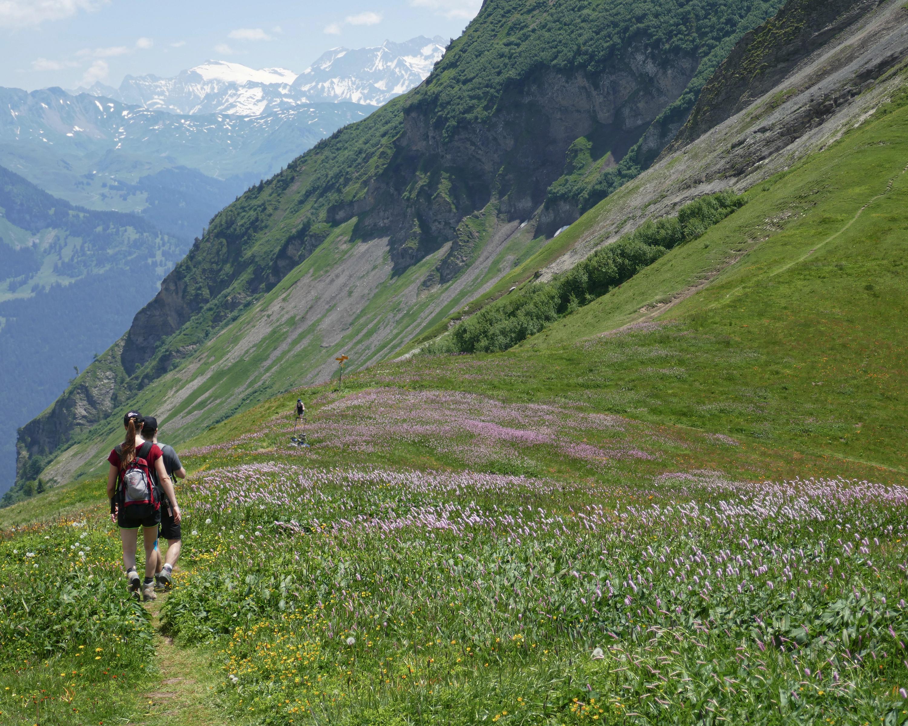
The popular Schönbüel-Brünigpass route is a feast for all the senses and is not short of gorgeous views. Along the way, the Gibel mountain will serve as your spectacular front-row seat, with views of Lake Brienz and Lake Thun below. Then comes a ridge walk towards the Wilerhorn, before the route leads down through woodland and meadows to the Brünig Pass.

..Br%C3%BCnigpass&freizeit=1&noweather=1&width=400&height=200&x_axis_display=distance&polyline=c%60uf%40ulbJm%7CB%3FzCj%40OaDbC%7C%40KsCtC%5CGyCdCdAIwCxAfBCqCzAfBCyC%60BxBEcDv%40fBJoC%7DBdB%7C%40eDyA%7CA%60%40cCiBfBb%40wCqB%7EAb%40wCcA%7EB%40%7DC%7BAlBb%40sCeA%7EBZuCoAdCT%7DCyAxBRyCaBhBRqCuBzAByCoC%60%40ZsCuCdAPgD%7EA%7EA%5EkCH%7CBXwCo%40%7EBPwCw%40%7EBP_DBrBPmCVbCV%7BCS%7EBRwC%3FnBNuCpArBN_DKbAHsCeApBPqCOrC%5C%7DCcBjAPuCkBr%40VuCqAzAX%7BCiB%7EATyCcAzBXqCU%5Cb%40iDeBi%40HeC%7DAv%40%40wC%7DBh%40XyCwBdARcD_B%7EAXoCaCbAV%7BCgCl%40ToCkCn%40VwC%7DBvAVaDuArBXsCcA%7CBb%40qCGdBj%40uC%7BA%7CBn%40aDj%40p%40%5EuChC%40ToCg%40jAf%40aDaC%7E%40%5CqCcBbBb%40%7BCgAlCZcDkAfA%5BkCeAlBAsCsCGRwCmCf%40TyCqCg%40Z%7DCiC%7B%40l%40%7DCyB%5CZiCsBuAVuCqCqAXoDgBLf%40gCEdBVsCiCq%40d%40%7DCwB%7D%40%60%40qCcCKd%40yC%7DCUF_DmCjAAmDoBBJyByBw%40DsCeCjBn%40aEwBPL%7BBiA%60BLiCZlD%60%40qDiC%60%40RsCkCNJmC%7BAzAToCsB%7CB%5EmDw%40pBFcC_%40%7CBNwCkCbA%40gDa%40%7CANqCRxCJaDy%40%3F%5CqCcAiA%60%40eCqBHj%40cDkCKZoC%7C%40tCb%40cDw%40zBGiCwA%7EBFcDwBK%3FkCkA%7DBDwCaCuABeDuBy%40%3FgC)