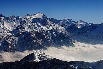
The
Rheinwaldhorn (Italian:
Adula) is the highest point in the Swiss canton of
Ticino ")
at 3,402 metres above sea level. It lies on the border between the cantons of Graubünden and Ticino, in the Adula massif, part of the St. Gotthard massif of the
Adula Alps in southern
Switzerland .
The mountain is known by different names, in German as
Rheinwaldhorn or
Adulahorn, in Italian as
l'Adula or
Piz Valrhein, in Romansh as
Piz Valragn. The group of the snowy peaks lying between the two principal branches of the
Rhine were known in the Middle Ages by the names
Mons Aquila or
Mons Avium. From the Romansh form of the first comes the name
Adula, which is used to designate the north-eastern portion of the
Lepontine Alps .

 Determining current location...