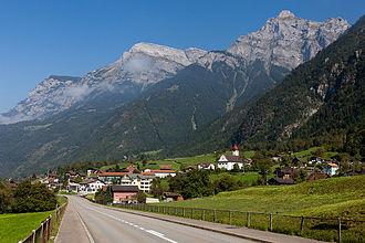
Geography
Silenen municipality comprises the villages of Silenen (divided into three parts, Dörfli, Russ, Rusli), Amsteg, and Acherli, besides numerous smaller hamlets or dispersed settlements, including Schützen, Buechholz, Öfibach, Dägerlohn, Frentschenberg, Ried (Vorderried, Hinterried), Maderanerthal valley (St. Anton = Vorderbristen, Bristen = Hinterbristen, Cholplatz, Hälteli, Steinmatte, Schattigmatt etc.), Hofstetten, Silblen, and the Golzeren plateau (Egg, Hüseren, Seewen, etc.)
Silenen has an area, as of 2006, of 144.8 km2 (55.9 sq mi). Of this area, 12.8% is used for agricultural purposes (mostly alpine pastures), while 18.3% is forested. Of the rest of the land, 0.7% is settled (buildings or roads) and the remainder (68.1%) is non-productive (mostly mountainous).
Arnisee ")
can be reached by gondola lift from Amsteg.

 Determining current location...