DE
FR
IT
EN
Directory
Weather
Map / Route
Timetable
Leisure
TV guide
Cinema
Snow
Web search
Apps
More
Personal Data »
Login:
Register
Password forgotten
or
Log in with local.ch
Log in with Apple
Log in with Facebook
Log in with Google
Log in with LinkedIn
Please note that our new
privacy statement
as well as the revised
terms and conditions of use
apply.
Leisure
Hike in Emmental
ViaJacobi, Stage 28/33
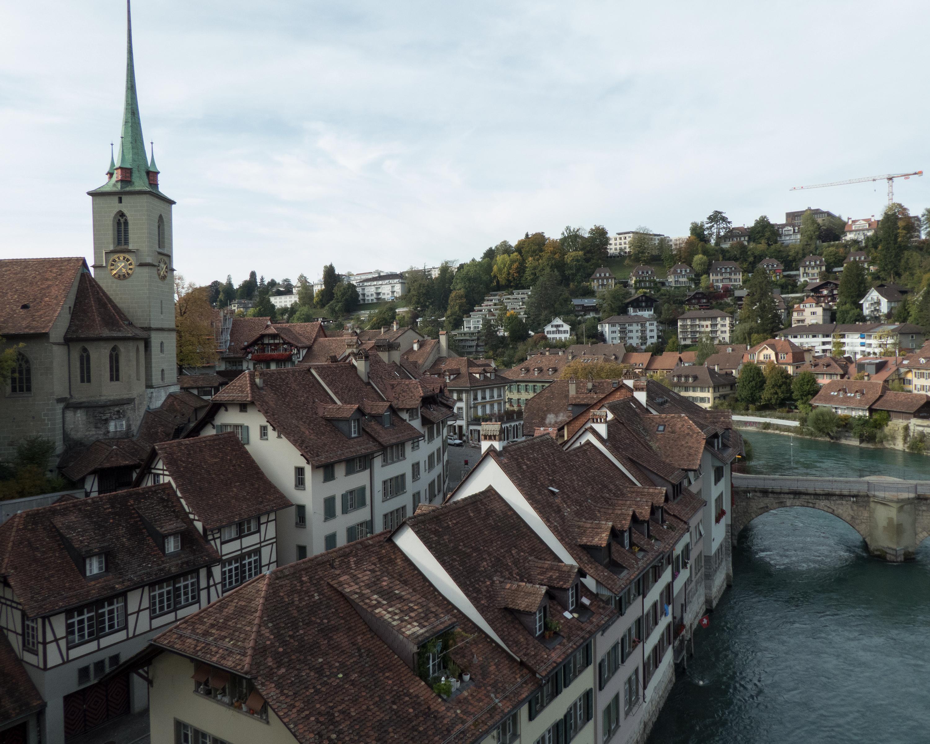
National route No. 4, Stage 29: Burgdorf – Bern (Bärengraben)
Description
National route
No. 4 ()
Length
30 km
Ascent • Descent
↑ 1000 m • ↓ 1000 m
Lowest point • Highest point
520 m • 854 m
Hiking time
8 h 10 min
Grade
easy
Fitness level
difficult
National route No. 4:
Stages
0. Schwyz – Stans
0. Wattwil – Rapperswil (SG)
0. Schwarzenburg – Fribourg
0. Wattenwil – Schwarzenburg
0. Rorschach – Herisau
0. Herisau – Wattwil
0. Fribourg – Romont (FR)
0. Fribourg (Villars-sur-Glâne) – Payerne
0. Brünigpass – Interlaken
0. Bern (Bärengraben) – Rüeggisberg
0. Willisau – Huttwil
0. Commugny – Genève
0. Lausanne – Rolle
0. Genève – Charrot (Grenze)
0. Wattwil (Neuhaus) – Siebnen
0. Interlaken – Spiez
0. Märstetten – Fischingen
0. Werthenstein – Willisau
0. Kreuzlingen (Konstanz, D) – Märstetten
0. Fischingen – Rapperswil (SG)
0. Romont (FR) – Moudon
0. Payerne – Moudon (Curtilles)
0. Spiez – Wattenwil
0. Moudon – Lausanne
0. Rapperswil (SG) – Einsiedeln
0. Huttwil – Burgdorf
0. Einsiedeln – Schwyz
0. Flüeli-Ranft – Brünigpass
0. Siebnen – Einsiedeln (St. Meinrad)
0. Stans – Flüeli-Ranft
0. Burgdorf – Bern (Bärengraben)
Several forest sections characterise the way from Burgdorf to Bern. Between Thorberg and Utzigen, you walk along the old monastery path for about eight kilometres. In the forest of Boll, sunken lanes have cut deeply into the surrounding terrain.
Comments on this information?
We welcome your feedback!
Presented by
Route
Height profile
Weather:
More...
Comments about this activity or place?
Incorrect information
Missing information
Another topic
Thank you for your feedback!
Close

&freizeit=1&noweather=1&width=400&height=200&x_axis_display=distance&polyline=q%60nd%40ok%7DKk%60%40%3F_CjMCsQeOvGYsQfBfJImSpLpGTwObMfI%3FeQfOpG%5BkSrL%7CBgAuOxP%7EBHsQnPxEKeRrJtLo%40mQQrNVeQqH%7EMp%40sQgGbMTwQ%7BBrPHeQjBxOLwQfElKQkQjAvK%5DmQs%40zKsAeQbQ%7B%40_%40%7DQfPrCc%40mQdPK_%40wQzPx%40u%40_Q%7ELhIw%40oQjNvJD%7BR%7D%40%60Nd%40kPb%40hK%5CqQxMdFe%40kQ%7E%40%60MNsQ%60H%7CHQ%7DQlLpJMiQnBrNr%40iQfHnGl%40mQ%7CJpFjBmQbOhDz%40sQxFvKFmQ%7ECjPAyQkGrNOwQiBxOw%40oQ%60HjFm%40aQoJpLeA_RoDlKyAaQuHdB%7D%40%7BQiAnMy%40iQaOtDw%40sQP%60Pm%40eQ%7CChOQaRtJdMSkQhLhKNeQtGbOh%40qQwJfLP%7BQnBfLBkQ%7CBpP%5DaR%5DlPDyPvBfQJwQvIlMPsQbEfOFsQLbQTiQjGpMtCoRnCxJfAeP%7CIjNTaTjKbAHeOnKlL%60AqQ%7CEdEjAuQ%7CLdFv%40cR%7CGjIJqPnJ%7EGBuQzJbKFmQbQvCFcSdE%7CL%5B%7BODlP_BmRc%40jP%7BA%7DPzMuBu%40oQdNzCcAgQjPZKuQxQqBCgRxPoCFqQ%7CKnFb%40oPzMzCf%40oRhNbChB%7BPvN%60Dd%40gQpPyD%60%40cRlOiFj%40mQbNyEDcQ%7EJ%7BNB_SdKiJDuPtBgPOeQ%7CFmMb%40qR%60OzBHaQvHxFOgQjEhL%40sQtHoLc%40uPxMsEC%7BQ%7EPZ%40wQnOdDB%7DPLnMf%40mS%7CJpJ%3FuOlIbFN%7BQhMzDKaQ%60J_MLwQbB_Mv%40gQ)