The
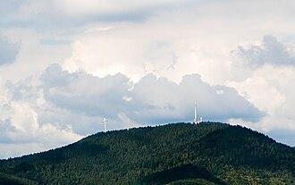
Brandenkopf is 945.2 m above sea level (NHN) and one of the highest mountains in the
Central Black Forest ")
in southern Germany. The mountain lies in the county of
Ortenaukreis in the state of Baden-Württemberg within the municipalities of
Oberharmersbach ,
Fischerbach and
Hausach , its summit is part of Oberharmersbach. The mountain forms the prominent centrepiece between the valleys of the Kinzig, the Wolf and the Harmersbach.
The name of the Brandenkopf ("Fire Peak") is derived from a great forest fire in 1730. Before this event it was called the Varnlehenskopf.
The Brandenkopf is well developed with roads and footpaths (including the Hansjakobweg II and a link to the West Way, 3.5 km away) from several directions.

 Determining current location...