DE
FR
IT
EN
Telefonbuch
Wetter
Karte / Route
Fahrplan
Freizeit
TV
Kino
Websuche
Apps
Mehr
Persönliche Informationen »
Anmelden:
Registrieren
Passwort vergessen
oder
Anmelden mit local.ch
Anmelden mit Apple
Anmelden mit Facebook
Anmelden mit Google
Anmelden mit LinkedIn
Bitte beachten Sie, dass unsere neue
Datenschutzerklärung
sowie die angepassten
Nutzungsbedingungen
gelten.
Freizeit
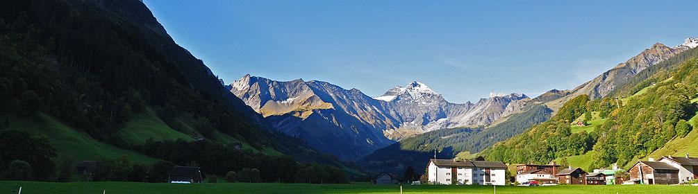
Wanderung in Luzern – Vierwaldstättersee
ViaSuworow, Etappe 7/11
Regionale Route Nr. 55, Etappe 7: Muotathal – Hinter Klöntal
Beschreibung
Regionale Route
Nr. 55 (Airolo – Ilanz)
Länge
19 km
Aufstieg • Abstieg
↑ 1100 m • ↓ 880 m
Tiefster Punkt • Höchster Punkt
625 m • 1550 m
Wanderzeit
6 h
Technik
mittel
Kondition
schwer
Regionale Route Nr. 55:
ViaSuworow
Etappen
1. Airolo – Gotthardpass
2. Gotthardpass – Andermatt
3. Andermatt – Wassen
4. Wassen – Altdorf
5. Altdorf – Biel-Chinzig
6. Biel-Chinzig – Muotathal
7. Muotathal – Hinter Klöntal
8. Hinter Klöntal – Glarus
9. Glarus – Elm
10. Elm – Pigniu
11. Pigniu – Ilanz
Mit Blick auf das Urwaldreservat Bödmeren, wo Suworow auf der Flucht vor den Franzosen durchmarschierte, geht es vom Muotatal auf Alpwegen und einem eindrücklichen Steinplattenweg in Schluecht über den Pragelpass nach Richisau im hinteren Klöntal.
Anmerkungen zu diesen Informationen?
Wir freuen uns über Ihr Feedback!
Präsentiert von
Route
Höhenprofil
Wetter:
Mehr...
Anmerkungen zu dieser Aktivität oder diesem Ort?
Falsche Angaben
Fehlende Informationen
Anderes Thema
Vielen Dank für dein Feedback!
Schliessen