DE
FR
IT
EN
Telefonbuch
Wetter
Karte / Route
Fahrplan
Freizeit
TV
Kino
Websuche
Apps
Mehr
Persönliche Informationen »
Anmelden:
Registrieren
Passwort vergessen
oder
Anmelden mit local.ch
Anmelden mit Apple
Anmelden mit Facebook
Anmelden mit Google
Anmelden mit LinkedIn
Bitte beachten Sie, dass unsere neue
Datenschutzerklärung
sowie die angepassten
Nutzungsbedingungen
gelten.
Freizeit
Wanderung in Vercorin
Chemin des Bisses, Etappe 7/7
Regionale Route Nr. 58, Etappe 7: Vercorin – Grimentz
Beschreibung
Regionale Route
Nr. 58 (Martigny (Col des Planches) – Grimentz)
Länge
17 km
Aufstieg • Abstieg
↑ 900 m • ↓ 680 m
Tiefster Punkt • Höchster Punkt
1002 m • 1578 m
Wanderzeit
5 h 25 min
Technik
leicht
Kondition
schwer
Regionale Route Nr. 58:
Chemin des Bisses
Etappen
1. Martigny (Col des Planches) – La Tzoumaz
2. La Tzoumaz – Nendaz
3. Nendaz – Veysonnaz
4. Veysonnaz – St-Martin
5. St-Martin – Nax
6. Nax – Vercorin
7. Vercorin – Grimentz
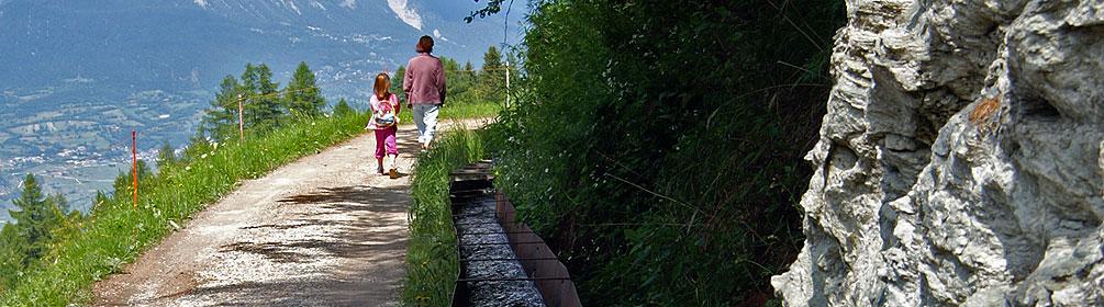
Die vor etwa 500 Jahren erstellte Suone «Bisse des Sarrasins» und ihre 17 Lehrtafeln sind aus historischer und technischer Sicht sehr interessant. Die Route führt danach über die Suone «Grand Bisse de St-Jean» zum typischen Walliser Dorf Grimentz.
Anmerkungen zu diesen Informationen?
Wir freuen uns über Ihr Feedback!
Präsentiert von
Route
Höhenprofil
Wetter:
Mehr...
Anmerkungen zu dieser Aktivität oder diesem Ort?
Falsche Angaben
Fehlende Informationen
Anderes Thema
Vielen Dank für dein Feedback!
Schliessen