DE
FR
IT
EN
Telefonbuch
Wetter
Karte / Route
Fahrplan
Freizeit
TV
Kino
Websuche
Apps
Mehr
Persönliche Informationen »
Anmelden:
Registrieren
Passwort vergessen
oder
Anmelden mit local.ch
Anmelden mit Apple
Anmelden mit Facebook
Anmelden mit Google
Anmelden mit LinkedIn
Bitte beachten Sie, dass unsere neue
Datenschutzerklärung
sowie die angepassten
Nutzungsbedingungen
gelten.
Freizeit
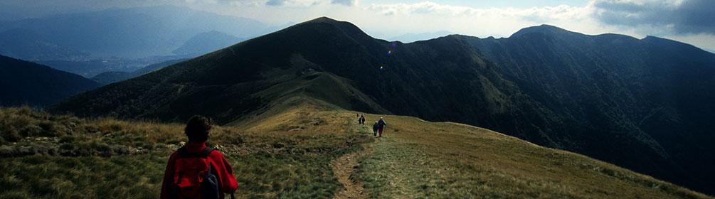
Wanderung in Lugano
Sentiero Lago di Lugano, Etappe 3/9
Regionale Route Nr. 52, Etappe 3: Cap. Tamaro – Medeglia
Beschreibung
Regionale Route
Nr. 52 (Lugano (Magliaso) – Mendrisio)
Länge
21 km
Aufstieg • Abstieg
↑ 900 m • ↓ 2100 m
Tiefster Punkt • Höchster Punkt
468 m • 1851 m
Wanderzeit
7 h
Technik
mittel
Kondition
schwer
Regionale Route Nr. 52:
Sentiero Lago di Lugano
Etappen
1. Lugano (Magliaso) – Miglieglia
2. Miglieglia – Cap. Tamaro
3. Cap. Tamaro – Medeglia
4. Medeglia – Cap. M. Bar
5. Cap. M. Bar – Cap. Pairolo
6. Cap. Pairolo – Lugano (M. Brè)
7. Lugano (Paradiso) – Morcote
8. Morcote – Riva S. Vitale (Capolago)
9. Riva S. Vitale (M. Generoso) – Mendrisio
Im Gegensatz zur sehenswerten Botta-Kirche auf der Alpe Foppa unterhalb des Monte Tamaro sind die Monti di Medeglia unbekannt, ein Geheimtipp. Denn nirgends sonst hat man einen so direkten Einblick sowohl ins Süd- wie ins Nordtessin.
Anmerkungen zu diesen Informationen?
Wir freuen uns über Ihr Feedback!
Präsentiert von
Route
Höhenprofil
Wetter:
Mehr...
Anmerkungen zu dieser Aktivität oder diesem Ort?
Falsche Angaben
Fehlende Informationen
Anderes Thema
Vielen Dank für dein Feedback!
Schliessen