DE
FR
IT
EN
Telefonbuch
Wetter
Karte / Route
Fahrplan
Freizeit
TV
Kino
Schnee
Websuche
Apps
Mehr
Persönliche Informationen »
Anmelden:
Registrieren
Passwort vergessen
oder
Anmelden mit local.ch
Anmelden mit Apple
Anmelden mit Facebook
Anmelden mit Google
Anmelden mit LinkedIn
Bitte beachten Sie, dass unsere neue
Datenschutzerklärung
sowie die angepassten
Nutzungsbedingungen
gelten.
Freizeit
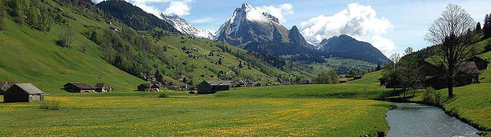
Wanderung in Wildhaus
Thurweg
Regionale Route Nr. 24, Wildhaus, Gamplüt – Rüdlingen
Beschreibung
Regionale Route
Nr. 24 (Wildhaus, Gamplüt – Rüdlingen)
Länge
160 km
Aufstieg • Abstieg
↑ 1900 m • ↓ 2900 m
Tiefster Punkt • Höchster Punkt
344 m • 1354 m
Technik
mittel
Kondition
schwer
Regionale Route Nr. 24: Thurweg
Etappen
0. Bischofszell – Weinfelden
0. Frauenfeld – Andelfingen
0. Nesslau – Wattwil
0. Schwarzenbach SG – Bischofszell
0. Wattwil – Schwarzenbach SG
0. Weinfelden – Frauenfeld
0. Wildhaus, Gamplüt – Nesslau
0. Andelfingen – Rüdlingen
Die Route folgt der Thur von ihren Ursprüngen am Säntis, durch die vielfältigen Landschaften des Toggenburgs, in die Weiten des Thurtals bis ins Zürcher Weinland, wo die Thur in den Rhein mündet.
Anmerkungen zu diesen Informationen?
Wir freuen uns über Ihr Feedback!
Präsentiert von
Route
Höhenprofil
Wetter:
Mehr...
Anmerkungen zu dieser Aktivität oder diesem Ort?
Falsche Angaben
Fehlende Informationen
Anderes Thema
Vielen Dank für dein Feedback!
Schliessen