search.ch

Berner Oberland-Route, Stage 2/2

Regional route No. 61, Stage 2: Interlaken – Meiringen
  • Image 1

Description

Regional route
No. 61 (Thun (Steffisburg) – Meiringen)
Length
51 km
Ascent • Descent
↑ 1600 m • ↓ 1600 m
Lowest point • Highest point
566 m • 1963 m
Fitness level
difficult
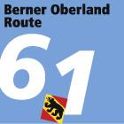
Regional route No. 61: Berner Oberland-Route
Stages
0. Interlaken – Meiringen
0. Thun (Steffisburg) – Interlaken
This route rises along the river Lütschine to Grindelwald, the glacier village in the foothills of the Eiger, Mönch and Jungfrau mountains. As you climb the Grosse Scheidegg, the terrain becomes more demanding. The route sweeps briskly past the Rosenlaui Glacier Gorge and Reichenbach Falls where, as the story goes, Sherlock Holmes fell to his death. Your destination for this tour is Meiringen.

Height profile

Weather:

Comments about this activity or place?

Thank you for your feedback!