search.ch

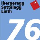
Ibergeregg–Sattelegg–Linth, Stage 2/2

Regional route No. 76, Stage 2: Einsiedeln (Willerzell) – Uznach
  • Image 1

Description

Regional route
No. 76 (Schwyz – Uznach)
Length
28 km
Ascent • Descent
↑ 440 m • ↓ 950 m
Lowest point • Highest point
406 m • 1190 m
Fitness level
medium
Regional route No. 76: Ibergeregg–Sattelegg–Linth
Stages
0. Einsiedeln (Willerzell) – Uznach
0. Schwyz – Einsiedeln (Willerzell)
Another strenuous stretch, the Sattelegg, a lovely mosaic landscape with an Alpine panorama, then flat land far below, which is a transit area for electricity and traffic, and a drained expanse with an interplay between farming tradition, dog walking and warehouses.

Height profile

Weather:

Comments about this activity or place?

Thank you for your feedback!