DE
FR
IT
EN
Telefonbuch
Wetter
Karte / Route
Fahrplan
Freizeit
TV
Kino
Websuche
Apps
Mehr
Persönliche Informationen »
Anmelden:
Registrieren
Passwort vergessen
oder
Anmelden mit local.ch
Anmelden mit Apple
Anmelden mit Facebook
Anmelden mit Google
Anmelden mit LinkedIn
Bitte beachten Sie, dass unsere neue
Datenschutzerklärung
sowie die angepassten
Nutzungsbedingungen
gelten.
Freizeit
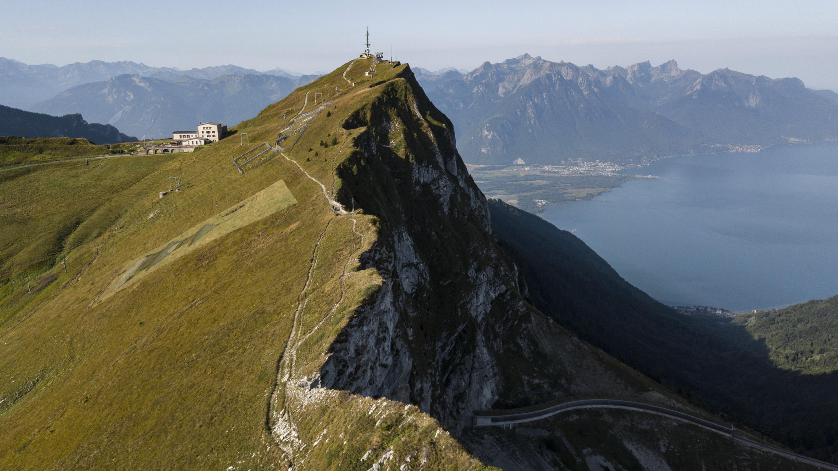
Wanderung in Villeneuve VD
Via Alpina, Etappe 20/20
Nationale Route Nr. 1, Etappe 20: Rochers de Naye – Montreux
Beschreibung
Nationale Route
Nr. 1 (Vaduz – Montreux)
Länge
13 km
Aufstieg • Abstieg
↑ 90 m • ↓ 1650 m
Tiefster Punkt • Höchster Punkt
375 m • 1951 m
Wanderzeit
3 h 50 min
Technik
mittel
Kondition
schwer
Nationale Route Nr. 1:
Via Alpina
Etappen
1. Vaduz (Gaflei, FL) – Sargans
2. Sargans – Weisstannen
3. Weisstannen – Elm
4. Elm – Linthal
5. Linthal – Urner Boden
6. Urner Boden – Altdorf (UR)
7. Altdorf (UR) – Engelberg
8. Engelberg – Engstlenalp
9. Engstlenalp – Meiringen
10. Meiringen – Grindelwald
11. Grindelwald – Lauterbrunnen
12. Lauterbrunnen – Griesalp
13. Griesalp – Kandersteg
14. Kandersteg – Adelboden
15. Adelboden – Lenk
16. Lenk – Gstaad
17. Gstaad – L'Etivaz
18. L'Etivaz – Rossinière
19. Rossinière – Rochers de Naye
20. Rochers de Naye – Montreux
Vom Rochers de Naye, dem Felsenrestaurant und einem Panorama über Hunderten von Zacken und Gipfeln geht es über einen steilen Grat- und Kalkfelswandweg, später über mediterrane Anhöhen, hinunter nach Montreux.
Anmerkungen zu diesen Informationen?
Wir freuen uns über Ihr Feedback!
Präsentiert von
Route
Höhenprofil
Wetter:
Mehr...
Anmerkungen zu dieser Aktivität oder diesem Ort?
Falsche Angaben
Fehlende Informationen
Anderes Thema
Vielen Dank für dein Feedback!
Schliessen