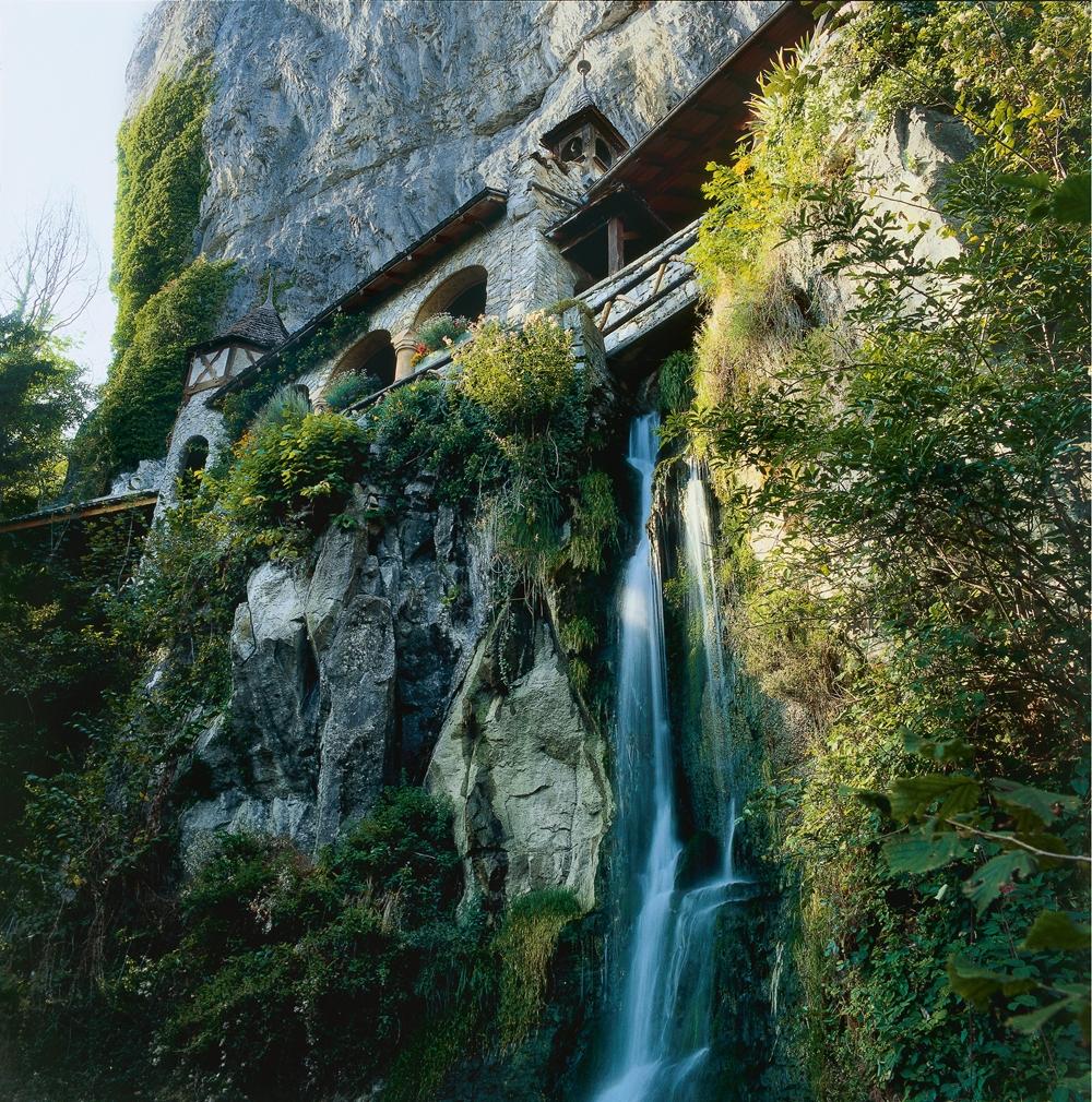
search.ch

ViaJacobi, Stage 10/33

National route No. 4, Stage 10: Interlaken – Spiez
  • Image 1

Description

National route
No. 4 ()
Length
13 km
Ascent • Descent
↑ 420 m • ↓ 440 m
Lowest point • Highest point
558 m • 727 m
Hiking time
3 h 45 min
Grade
easy
Fitness level
medium
National route No. 4:
Stages
1. Rorschach – Herisau
2. Herisau – Wattwil
3. Wattwil – Rapperswil (SG)
4. Rapperswil (SG) – Einsiedeln
5. Einsiedeln – Schwyz
6. Schwyz – Stans
7. Stans – Flüeli-Ranft
8. Flüeli-Ranft – Brünigpass
9. Brünigpass – Interlaken
10. Interlaken – Spiez
11. Spiez – Wattenwil
12. Wattenwil – Schwarzenburg
13. Schwarzenburg – Fribourg
14. Fribourg – Romont (FR)
15. Romont (FR) – Moudon
16. Moudon – Lausanne
17. Lausanne – Rolle
19. Coppet – Genève
20. Genève – Genève (Grenze)
21. Kreuzlingen (Konstanz, D) – Märstetten
22. Märstetten – Fischingen
23. Fischingen – Rapperswil (SG)
26. Werthenstein – Willisau
27. Willisau – Huttwil
28. Huttwil – Burgdorf
29. Burgdorf – Bern (Bärengraben)
30. Bern (Bärengraben) – Rüeggisberg
32. Fribourg (Villars-sur-Glâne) – Payerne
33. Payerne – Moudon (Curtilles)
34. Wattwil (Neuhaus) – Siebnen
35. Siebnen – Einsiedeln (St. Meinrad)
This leg leads along the banks of the Aare to the Weissenau nature conservation area by Lake Thun. From Neuhaus, the route takes you through woodland with lots of unobstructed views of Lake Thun and a panorama of the Bernese Alps. The St. Beatus caves with their stalactites and stalagmites, grottos, gorges and streams are particularly impressive.

Height profile

Weather:

Comments about this activity or place?

Thank you for your feedback!