DE
FR
IT
EN
Telefonbuch
Wetter
Karte / Route
Fahrplan
Freizeit
TV
Kino
Websuche
Apps
Mehr
Persönliche Informationen »
Anmelden:
Registrieren
Passwort vergessen
oder
Anmelden mit local.ch
Anmelden mit Apple
Anmelden mit Facebook
Anmelden mit Google
Anmelden mit LinkedIn
Bitte beachten Sie, dass unsere neue
Datenschutzerklärung
sowie die angepassten
Nutzungsbedingungen
gelten.
Freizeit
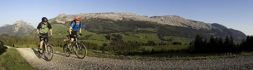
Mountainbike in Sörenberg
Panorama Bike, Etappe 9/14
Nationale Route Nr. 2, Etappe 9: Sörenberg – Habkern
Beschreibung
Nationale Route
Nr. 2 (Rorschach – Montreux)
Länge
32 km
Aufstieg • Abstieg
↑ 1150 m • ↓ 1300 m
Tiefster Punkt • Höchster Punkt
1041 m • 1636 m
Technik
mittel
Kondition
mittel
Nationale Route Nr. 2:
Panorama Bike
Etappen
1. Rorschach – Trogen
2. Trogen – Appenzell
3. Appenzell – Stein SG
4. Stein SG – Ziegelbrücke
5. Ziegelbrücke – Einsiedeln
6. Einsiedeln – Schwyz
7. Schwyz – Sarnen
8. Sarnen – Sörenberg
9. Sörenberg – Habkern
10. Habkern – Thun
11. Thun – Schwarzsee
12. Schwarzsee – Charmey
13. Charmey – Les Paccots
14. Les Paccots – Montreux
Die Region von Sörenberg ist eine urtümliche Hochmoorlandschaft mit lichten Tannenwäldern. Alte Polenwege, steile Schotterwege und kleine Alpstrassen führen durch die weltentrückte Grenzregion zwischen der Zentralschweiz und dem Berner Oberland.
Anmerkungen zu diesen Informationen?
Wir freuen uns über Ihr Feedback!
Präsentiert von
Route
Höhenprofil
Wetter:
Mehr...
Anmerkungen zu dieser Aktivität oder diesem Ort?
Falsche Angaben
Fehlende Informationen
Anderes Thema
Vielen Dank für dein Feedback!
Schliessen