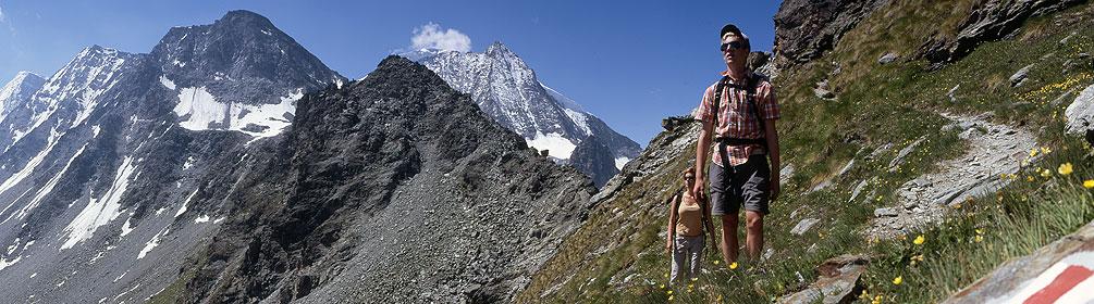
search.ch

Alpine Passes Trail, Stage 28/43

National route No. 6, Stage 28: Cab. des Dix – Cab. de Prafleuri
  • Image 1

Description

National route
No. 6 (St. Moritz, Corviglia – St-Gingolph)
Length
12 km
Ascent • Descent
↑ 600 m • ↓ 860 m
Lowest point • Highest point
2370 m • 2956 m
Hiking time
4 h 10 min
Grade
medium
Fitness level
medium
National route No. 6: Alpine Passes Trail
Stages
1. St. Moritz, Corviglia – Jenatschhütte SAC
2. Jenatschhütte SAC – Sur GR, Alp Flix
3. Sur GR, Alp Flix – Savognin
4. Savognin – Ausserferrera
5. Ausserferrera – Splügen
6. Splügen – Turra
7. Turra – Vella
8. Vella – Vrin
9. Vrin – Cap. Scaletta
10. Cap. Scaletta – Cap. Bovarina
11. Cap. Bovarina – Cap. Cadagno
12. Cap. Cadagno – Airolo
13. Airolo – Cap. Corno-Gries
14. Cap. Corno-Gries – Rif. Margaroli
15. Rif. Margaroli – Binn
16. Binn – Rosswald
17. Rosswald – Simplon Hospiz
18. Simplon Hospiz – Gspon
19. Gspon – Saas Fee
20. Saas Fee – Grächen
21. Grächen – Gruben
22. Gruben – Hotel Weisshorn
23. Hotel Weisshorn – Grimentz
24. Grimentz – Cab. des Becs de Bosson
25. Cab. des Becs de Bosson – Evolène
26. Evolène – Arolla
27. Arolla – Cab. des Dix
28. Cab. des Dix – Cab. de Prafleuri
29. Cab. de Prafleuri – Cab. de Louvie
30. Cab. de Louvie – Mauvoisin
31. Mauvoisin – Cab. de Brunet
32. Cab. de Brunet – Bourg-St-Pierre
33. Bourg-St-Pierre – Col du Gd St-Bernard
34. Col du Gd St-Bernard – La Fouly
35. La Fouly – Champex-Lac
36. Champex – Trient
37. Trient – Lac d’Emosson
38. Lac d’Emosson – Cab. de Salanfe
39. Cab. de Salanfe – Barme
40. Barme – Morgins
41. Morgins – Torgon
42. Torgon – Taney
43. Taney – St-Gingolph
The stage begins with a steep descent to the Lac des Dix reservoir and the highest gravity dam in the world. The path continues along the lake, then up to the Col des Roux. From there it is only a short distance to where this stage finishes, at the Cabane de Prafleuri SAC hut.

Height profile

Weather:

Comments about this activity or place?

Thank you for your feedback!