DE
FR
IT
EN
Telefonbuch
Wetter
Karte / Route
Fahrplan
Freizeit
TV
Kino
Websuche
Apps
Mehr
Persönliche Informationen »
Anmelden:
Registrieren
Passwort vergessen
oder
Anmelden mit local.ch
Anmelden mit Apple
Anmelden mit Facebook
Anmelden mit Google
Anmelden mit LinkedIn
Bitte beachten Sie, dass unsere neue
Datenschutzerklärung
sowie die angepassten
Nutzungsbedingungen
gelten.
Freizeit
Wanderung in Davos
Walserweg, Etappe 17/19
Regionale Route Nr. 35, Etappe 17: Langwies – Klosters
Beschreibung
Regionale Route
Nr. 35 (San Bernardino – Brand (A))
Länge
23 km
Aufstieg • Abstieg
↑ 1100 m • ↓ 1350 m
Tiefster Punkt • Höchster Punkt
1118 m • 2337 m
Wanderzeit
7 h 10 min
Technik
mittel
Kondition
schwer
Regionale Route Nr. 35:
Walserweg
Etappen
1. San Bernardino – Hinterrhein
2. Hinterrhein – Vals
3. Vals – Safien-Platz
4. Turrahus – Safien Platz
5. Safien-Platz – Thusis
6. Thusis – Obermutten
7. Obermutten – Andeer
8. Andeer – Innerferrera
9. Innerferrera – Juf
10. Juf – Alp Flix
11. Alp Flix – Chamonas d’Ela CAS
12. Chamonas d’Ela CAS – Monstein
13. Monstein – Sertig Dörfli
14. Sertig Dörfli – Davos
15. Davos – Arosa
16. Arosa – Langwies
17. Langwies – Klosters
18. Klosters – St. Antönien
19. St. Antönien – Brand (A)
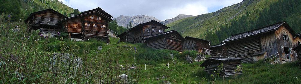
Die Wanderung von Langwies nach Klosters ist anspruchsvoll und wird aber mit unberührten Kulturlandschaften und weiten Alpengebieten belohnt. Für einen Einblick in das Leben der Walser Bauern empfiehlt sich ein Besuch im Heimatmuseum Nutli Hüschi.
Anmerkungen zu diesen Informationen?
Wir freuen uns über Ihr Feedback!
Präsentiert von
Route
Höhenprofil
Wetter:
Mehr...
Anmerkungen zu dieser Aktivität oder diesem Ort?
Falsche Angaben
Fehlende Informationen
Anderes Thema
Vielen Dank für dein Feedback!
Schliessen