DE
FR
IT
EN
Telefonbuch
Wetter
Karte / Route
Fahrplan
Freizeit
TV
Kino
Websuche
Apps
Mehr
Persönliche Informationen »
Anmelden:
Registrieren
Passwort vergessen
oder
Anmelden mit local.ch
Anmelden mit Apple
Anmelden mit Facebook
Anmelden mit Google
Anmelden mit LinkedIn
Bitte beachten Sie, dass unsere neue
Datenschutzerklärung
sowie die angepassten
Nutzungsbedingungen
gelten.
Freizeit
Wanderung in Val Bedretto / Bedrettotal
Trans Swiss Trail, Etappe 24/32
Nationale Route Nr. 2, Etappe 24: Passo del S. Gottardo – Airolo
Beschreibung
Nationale Route
Nr. 2 (Porrentruy – Mendrisio)
Länge
7 km
Aufstieg • Abstieg
↑ 20 m • ↓ 950 m
Tiefster Punkt • Höchster Punkt
1145 m • 2093 m
Wanderzeit
2 h
Technik
mittel
Kondition
schwer
Nationale Route Nr. 2:
Trans Swiss Trail
Etappen
1. Porrentruy – Saint-Ursanne
2. Saint-Ursanne – Soubey
3. Soubey – Saignelégier
4. Saignelégier – St-Imier
5. St-Imier – Chézard St-Martin
6. Chézard St-Martin – Neuchâtel
7. Neuchâtel – Murten
8. Murten – Laupen
9. Laupen – Bern
10. Bern – Worb
11. Worb – Lützelflüh
12. Lützelflüh – Langnau i.E.
13. Langnau i.E. – Eggiwil
14. Eggiwil – Schangnau
15. Schangnau – Sörenberg
16. Sörenberg – Giswil
17. Giswil – Flüeli-Ranft
18. Flüeli-Ranft – Stans
19. Stans – Seelisberg
20. Seelisberg – Erstfeld
21. Erstfeld – Wassen
22. Wassen – Andermatt
23. Andermatt – Passo del S. Gottardo
24. Passo del S. Gottardo – Airolo
25. Airolo – Osco
26. Osco – Anzonico
27. Anzonico – Biasca
28. Biasca – Bellinzona
29. Bellinzona – Tesserete
30. Tesserete – Lugano (Comano)
31. Lugano (Paradiso) – Morcote
32. Morcote – Mendrisio
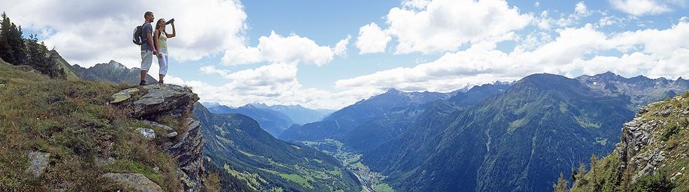
Vom König der Schweizer Pässe auf steilem Bergwanderweg hinunter in die Leventina. Spektakuläre alpine Bergwelt kombiniert mit verkehrsbaulichen Meisterleistungen verschiedener Epochen. Auf Tuchfühlung mit der denkmalgeschützten Tremolapasstrasse.
Anmerkungen zu diesen Informationen?
Wir freuen uns über Ihr Feedback!
Präsentiert von
Route
Höhenprofil
Wetter:
Mehr...
Anmerkungen zu dieser Aktivität oder diesem Ort?
Falsche Angaben
Fehlende Informationen
Anderes Thema
Vielen Dank für dein Feedback!
Schliessen

 Trans Swiss Trail, Etappe 24/32