DE
FR
IT
EN
Telefonbuch
Wetter
Karte / Route
Fahrplan
Freizeit
TV
Kino
Schnee
Websuche
Apps
Mehr
Persönliche Informationen »
Anmelden:
Registrieren
Passwort vergessen
oder
Anmelden mit local.ch
Anmelden mit Apple
Anmelden mit Facebook
Anmelden mit Google
Anmelden mit LinkedIn
Bitte beachten Sie, dass unsere neue
Datenschutzerklärung
sowie die angepassten
Nutzungsbedingungen
gelten.
Freizeit
Wanderung in Yverdon-les-Bains
Chemin des Trois-Lacs
Regionale Route Nr. 71, Yverdon-les-Bains – Murten
Beschreibung
Regionale Route
Nr. 71 (Yverdon-les-Bains – Murten)
Länge
61 km
Aufstieg • Abstieg
↑ 760 m • ↓ 740 m
Tiefster Punkt • Höchster Punkt
429 m • 648 m
Technik
leicht
Kondition
schwer
Regionale Route Nr. 71: Chemin des Trois-Lacs
Etappen
0. Estavayer-le-Lac – Portalban
0. Yverdon-les-Bains – Estavayer-le-Lac
0. Portalban – Murten
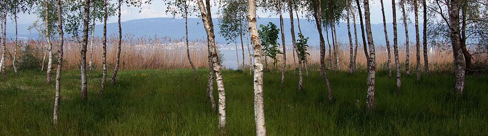
«Wasser ist Leben», dieses einfache Naturgesetz gilt besonders für das Drei-Seen-Land. Der «Chemin des Trois-Lacs» führt entlang naturbelassener Uferregionen, durch Schilfgürtel und hin zu Naturschutzzentren welche über sensible Themen informieren.
Anmerkungen zu diesen Informationen?
Wir freuen uns über Ihr Feedback!
Präsentiert von
Route
Höhenprofil
Wetter:
Mehr...
Anmerkungen zu dieser Aktivität oder diesem Ort?
Falsche Angaben
Fehlende Informationen
Anderes Thema
Vielen Dank für dein Feedback!
Schliessen